Issue Date: Wednesday, June 13th, 2018
Issue Time: 10:20 AM MDT
Summary:
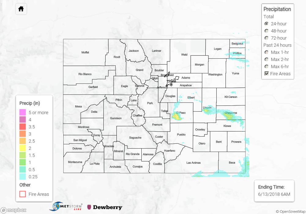
All was mainly quiet across Colorado yesterday during the daylight hours, with high pressure ridging and sunshine dominating the state. As the day turned to night and early morning, a surge of moisture from the southeast invaded eastern Colorado and kicked off isolated thunderstorms across portions of the Urban Corridor, Palmer Ridge, Northeast Plains, Southeast Plains, and Raton Ridge. Most were run-of-the-mill, producing plenty of lightning, periods of light-to-moderate rainfall, gusty winds, and small hail. However, one storm was able to outperform the rest, bringing large hail to El Paso County between Midnight and 2:00 AM. Take a look at some of the larger hail reports from this isolated storm:
– 3.00 inch diameter hail: 3 miles WSW Peterson AFB
– 2.50 inch diameter hail: Fountain, 2 miles NE of Fountain
– 2.00 inch diameter hail: 2 miles SE of Security, 2 miles WSW Peterson AFB
– 1.75 inch diameter hail: Fountain
– 1.50 inch diameter hail: 3 miles ESE of Security, 3 miles W Peterson AFB
– Plus a handful of 1 inch and 1.25 inch reports.
No flash flooding was reported yesterday. For a look at precipitation estimates in your area, please see our State Precipitation Map below.
Click Here For Map Overview
Note: We have identified a possible underestimation in QPE over the southwest part of the state. We are working to on this issue, and will provide an update as soon as possible.