Issue Date: Friday, May 5th, 2015
Issue Time: 9:00 AM MDT
Summary:
FLOOD WARNINGS/ADVISORIES CONTINUE FOR PORTIONS OF THE CACHE LA POUDRE RIVER, SOUTH PLATTE RIVER, SOUTH BOULDER CREEK AND LITTLE THOMPSON RIVER.
Very high dewpoints, approaching 60 to 65 F over eastern Colorado fueled a very impressive array of strong and severe thunderstorms. Action began along the Palmer Divide in the early afternoon where slow moving, or even stationary thunderstorms first began to cause hail. The first cell, by Elizabeth, CO, caused an outflow boundary that jump-started a wave of cells lasting into the afternoon, evening and even overnight hours. The following severe weather was observed:
Tornadoes
At least two separate supercells produced tornadoes. One near Simla, and the other near Berthoud. Both were well documented on various social media outlets. There was some reported damage with the Simla storm, and both were certainly quite impressive for Colorado tornado standards.
Hail
Though it is not enjoyable when big hail damages and destroys objects on our property, the incredible amount of hail in yesterday’s storms saved many from a much more serious flooding threat. Hail takes time to melt and add to runoff, and can be a huge difference maker in preventing flooding. For example, one CoCoRaHS observer noted that about 25% of the total reported rainfall, came from hail! Yesterday’s list of hail reports is lengthy and covers many cities and counties in the Palmer Divide, Northeast Plains and Urban Corridor areas. Some of the more impressive reports include:
- 2.75 inches in Simla, breaking windows and severely damaging cars
- 2.5 inch in Lyons
- 1.5 inch in Loveland
- Many reports of 0.5 to 1.0 inch hail lasting up to 30 minutes
Heavy Rainfall
Thunderstorm rainfall increased in intensity as the evening wore on. Early storms were capable of producing about 1.0 – 1.25 inches per hour. During the late afternoon and early evening, max 1-hr rainfall rates increased to about 1.7 inches per hour. However, this does not do justice in describing short-term rainfall, which was well observed on the Urban Drainage ALERT network. Several gauges picked up 0.35 to 0.50 inches of rain in 5 minutes! Fortunately, most individual storm updrafts were only sustained for 30-45 minutes.
The highest 24-hour rain total came from the tornadic cell near Berthoud where several observers noted over 3 inches of rain. Several other 2 inch + reports were received from Boulder and Larimer counties. Many other locations in the Northeast Plains, Urban Corridor and Palmer Ridge experienced anywhere from 1 to 1.8 inches of rain.
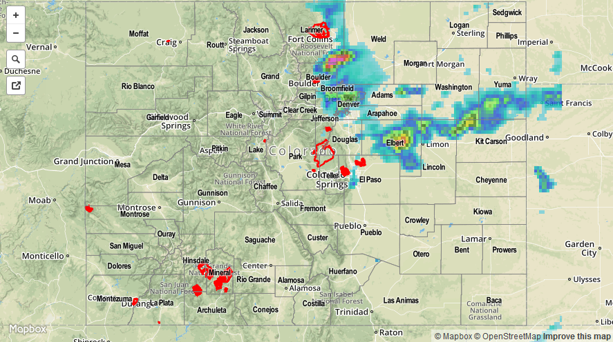
For estimated rainfall in your area, be sure to check out the rainfall map below. NOTE: hail contamination caused severe overestimates in rainfall amounts. For example, radar estimates of the Berthoud storm (Larimer/Boulder counties) were in the 5-7 inch range, while highest observed values were around 3.5 inches. This is also likely the case with the Simla cell (Elbert County).