Issue Date: Thursday, June 7th, 2018
Issue Time: 2:00PM MDT
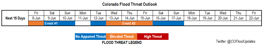
Valid Dates: 6/8 – 6/22
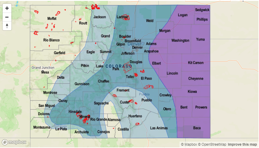
Once again Colorado will be under a ridging pattern for the majority of this FTO period, which will keep temperatures well above average for this time of year. A hot and dry air mass has established itself over the Great Basin and continues to extend these conditions into western Colorado. This has also limited heavy rainfall over the majority of the state as the dry air has purged the upper and low levels of the atmosphere of moisture. The exception to this is over the Northeast Plains where daily easterly flow has allowed low-level moisture to return. As diurnal flow storms form over the higher terrains and move eastward into the higher dew points, they are able to become more efficient with their rainfall rates. Beginning Saturday, the low pressure ridge over the Gulf of Alaska will slide north of Colorado and briefly displace the strong ridge and bring cooler temperatures to the state on Monday (Event #1).
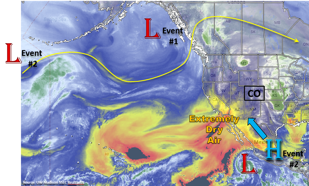
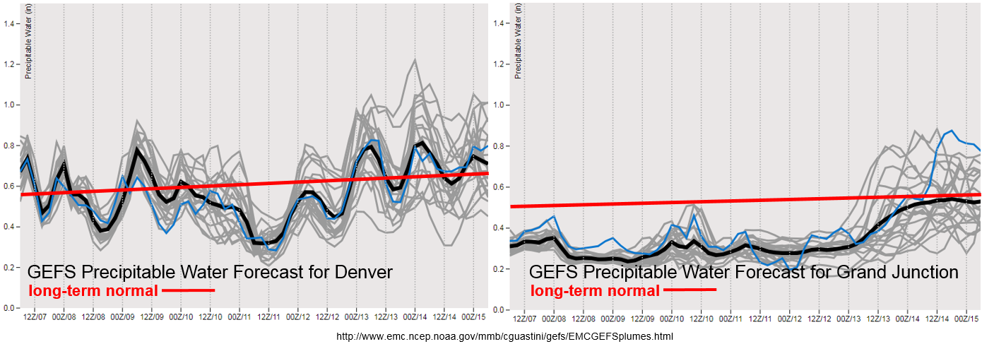
The Precipitable Water (PW) plumes below show the best moisture for Event #1 will be east of the Continental Divide once again. PW values increase each afternoon with easterly flow pulling in low-level moisture from the plains. By Monday, the PW values decrease below normal, which should give us a break from heavy rainfall until next Wednesday. At this time, PW begins to rise both east and west of the Divide as the Low and High pressure combine to pull in sub-tropical moisture into the state (Event #2). Disturbances within the ridge will help bring extra lift for thunderstorm development through the end of next week into the weekend. At this time there is a bit of uncertainty as to how far north the sub-tropical moisture will be pulled, but this could potentially create multiple days of heavy rainfall events. Even if high moisture doesn’t fully reach the state, there should be enough moisture for rounds of afternoon thunderstorms. Be sure to check back next Monday to see how the details of this event are evolving.
Below we describe each of the two identified precipitation events in more detail.
Event #1: Friday (6/8) – Sunday (6/10)
Elevated Flood Threat/No Apparent Threat as daily rounds of afternoon thunderstorms form over the high terrains.
Friday a similar pattern to the last 3 days with the possibility of severe storms and heavy rainfall over the far eastern plains. Low-level easterly flow will pull high dew points to the CO/KS border, which if the cap breaks, will create an Elevated flood threat. The details will become more apparent tomorrow morning, so check back to the FTB. This weekend, the low pressure over the Gulf of Alaska will slide inland just north of the state and providing increased lift for more numerous showers and thunderstorms over the northern mountains in the afternoon on Saturday. Moisture is expected to remain low enough that heavy rainfall is not expected. South, fire weather increases Saturday night into Sunday as the upper level trough increases wind speeds. Please use extra caution with open flames. By Monday, cooler temperatures and a more settled weather pattern are forecast to start the work week after the passage of a cold front Sunday night.

Event #2: Tuesday (6/12) – Friday (6/15)
Elevated Flood Threat/No Apparent Threat as a tropical moisture is potentially siphoned northward into the state.
Currently, the GFS is pulling the High pressure over Mexico north into Texas and New Mexico on Tuesday. Paired with another Low dropping south from the Gulf of Alaska, the two could unite to pull in abundant sub-tropical moisture into the state. If the moisture travels far enough north, this would allow afternoon thunderstorms to produce very high rainfall rates and create an Elevated flood threat. This forecast is likely to change quite a bit over the weekend, so check back to the FTO on Monday to find out more as the event evolves.