Issue Date: 6/2/2018
Issue Time: 9:30 AM
NO FLOOD THREAT IS FORECAST TODAY.
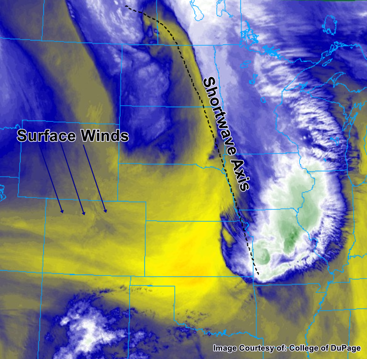
The trough of low pressure that passed just to the north of Colorado yesterday has swiftly moved off to the east, and in its wake has shifted the general wind direction from the south/southwest to more northerly with the passage of a cold front. These north winds mean that daytime high temperatures will be up to 10 degrees cooler across much of Colorado. Most importantly, for the southern part of the state, there is a substantial decrease in the risk of dangerous fire conditions, due in part to the wind shift as well as higher relative humidity and reduced wind gusts.
Aloft, winds remain westerly, which will bring in drier air to the upper atmosphere above Colorado. This, in conjunction with broad subsidence, will make it exceptionally difficult for any afternoon thunderstorms or showers to develop across the state. Expect a few cumulus over the mountains, although it should be a rain free and clear day across Colorado. So, if you can, get out and enjoy the sun and relatively cool conditions today before the chance of rainfall increases tomorrow.
Today’s Flood Threat Map
For more information on today’s flood threat, see the map below (hover over threat areas for more details). For Zone-Specific forecasts, jump below the map.


Zone-Specific Forecasts
Front Range, Urban Corridor, Palmer Ridge, Northeast Plains, Southeast Plains, Raton Ridge, Central Mountains, Southeast Mountains, and San Luis Valley:
Should be a clear day with temperatures much closer to average for this time of year. Temperatures will be up to 10F cooler than yesterday with the passage of the cold front. The few cumulus that are able to form over the mountains will provide no to trace amounts of rainfall. Expect a slight increase in cloud cover this afternoon.
Northern Mountains, Northwest Slope, Grand Valley, San Juan Mountains, and Southwest Slope:
Plenty of sunshine, with cooler temperatures compared to the latter part of the week. Critical fire danger has been lifted; however, the dry ground is still susceptible to burning. Please use caution with open flames. Overnight and into tomorrow morning, cloud cover and showers will begin to increase ahead of the disturbance on Sunday. They should be confined to the southwest corner of the state. Flooding is not expected today.
Timing: 4 AM to 11 AM