Issue Date: 5/31/2018
Issue Time: 8:20 AM
NO FLOOD THREAT IS FORECAST TODAY.
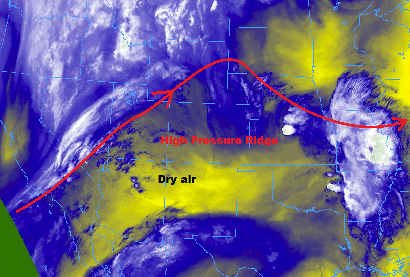
High pressure ridging aloft and dry, southwesterly flow aloft will suppress the atmosphere today, drying out the state and allowing temperatures to warm a few degrees as compared to yesterday. There is enough residual moisture for the development of scattered fair-weather cumulus clouds over and adjacent to the higher terrain, but that will be about all that Mother Nature can muster today.
One exception to the quiet rule will be over the Northern Mountains, the northern half of the Central Mountains, and the Front Range north of the Pike National Forest. In those regions, orographic effects and enough residual moisture will be able to overcome the weak cap to produce isolated, high-based showers/thunderstorms. It will remain too dry beneath the clouds for measurable rainfall; gusty winds and virga will be the main impacts, with only a brief sprinkle noted.
Today’s Flood Threat Map
For more information on today’s flood threat, see the map below (hover over threat areas for more details). For Zone-Specific forecasts, jump below the map.

Zone-Specific Forecasts
Urban Corridor, Northeast Plains, Southeast Plains, Palmer Ridge, and Raton Ridge:
Hot and dry with plenty of sunshine to go around. A few afternoon/evening fair weather cumulus clouds will be noted near the higher terrain of the Front Range, providing small pockets of shade, a few streaks of virga, and nothing more. The Urban Corridor and far western portions of the Northeast Plains, during the late afternoon/evening hours, may see an isolated shower/high-based thunderstorm as a result of mountain activity. The potential for this remains very low (10%), but it is possible so it deserves a mention. Rain rates from any activity will be less than 0.1 inches/hour.
Northern Mountains, Front Range, and Central Mountains:
Mostly sunny, warm, and dry will be the main weather result today as the atmosphere is lacking moisture and upper-level support to produce anything of substance. An isolated afternoon/evening high-based showers/thunderstorm triggered by a combination of orographic effects and daytime heating cannot be ruled out, but any such activity will result in more wind than rain. Maximum rain rates will be 0.05-0.1 inches/hour.
Timing: 3 PM – 9 PM
Northwest Slope, Central Mountains, Grand Valley, Southwest Slope, San Juan Mountains, Southeast Mountains, San Luis Valley:
Sunny, warm, and dry will be the name of the weather game today, as dry air and upper-level ridging conspire to create a “severe clear” day. Gusty winds, low relative humidity, and dry fuels mean that fire danger is elevated today. Red Flag Warnings have been issued for much of the area, so be sure to check with your local NWS office for more information.