Issue Date: Tuesday, May 29, 2018
Issue Time: 10:00AM MDT
— Flooding is NOT expected today
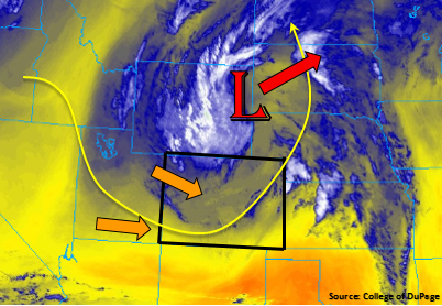
The upper wave marked in the water vapor imagery below will slowly track to the northeast throughout the day, which will put us under northwestly flow for most of the day. This should allow enough low-level moisture to hang on for another round of garden variety showers and thunderstorms over northern Colorado and the eastern plains. High temperatures will be down a bit as well over northeastern Colorado. Tonight and tomorrow the flow will gain more of a westerly component as the open wave moves out of Wyoming. This will begin drying out the atmosphere for the rest of the week and limit Colorado’s chances for afternoon rain.
Precipitable Water (PW) this morning at Denver was measured at 0.56 inches, which is quite a bit lower than yesterday. This means the drying process has begun and thunderstorms today will produce lighter rainfall rates and stronger winds. PW at Grand Junction is around the same with fairly decent moist mid-level moisture. Despite the decrease in moisture, dew points should be high enough to support scattered thunderstorms and showers this afternoon and evening over the northern high terrains and Northwest Slope.
The diurnal heating pattern and upper low should help trigger thunderstorms over the mountains just after noon. Coverage in the mountains will be greatest over the Northern Front Range and Northern Mountains, but more isolated storms will also fire further south. Small hail may occur, but limited instability should keep this around pea size. Over the eastern plains and Palmer Ridge, a dry line is expected to spark thunderstorm development later this afternoon. Numerous outflow boundaries from yesterday could also spin up a few thunderstorms. Higher dew points will increase rainfall amounts, but storm motion will be about 15-20 knots. This should limit heavy rainfall over any area. Thus, there is no flooding expected today. Without any upper support, storms will quickly fizzle out after sundown as instability rapidly decreases.
Today’s Flood Threat Map
For more information on today’s flood threat, see the map below. For Zone-Specific forecasts, scroll below the map.

Zone-Specific Forecasts:
Palmer Ridge, Front Range, Urban Corridor, Northern Mountains, Central Mountains, Northeast Plains, Southeast Plains, Northwest Slope:
More scattered thunderstorms are expected over the northern high terrains and Northwest Slope this afternoon. More isolated thunderstorms and showers for the Central Mountains and southern Front Range. Max 1-hour rain rates up to 0.3 inches (north) and 0.15 inches (south) are possible. Out over the eastern plains, more moisture could cause max 1-hour rain rates up to 1.1 inches. Decent storm motion and lack of high moisture should limit the flooding potential. Threats for stronger storms include hail up to 1.25 inches and wind gusts of 50 mph. Flooding is not expected today.
Primetime: 1PM – 8PM
San Luis Valley, San Juan Mountains, Southwest Slope, Southeast Mountains, Raton Ridge, Grand Valley:
More isolated showers and thunderstorms are expected over southern and western Colorado. Rain rates over the Southeast/San Juan Mountains and Raton Ridge should be under 0.1 inches/hour. Expect more afternoon clouds over the higher terrains than rainfall. Should be sunny, beautiful day elsewhere. There is no flood threat today.
Primetime: 2PM – 8PM