Issue Date: Monday, May 28th, 2018
Issue Time: 2:35PM MDT
Valid Dates: 5/29 – 6/12

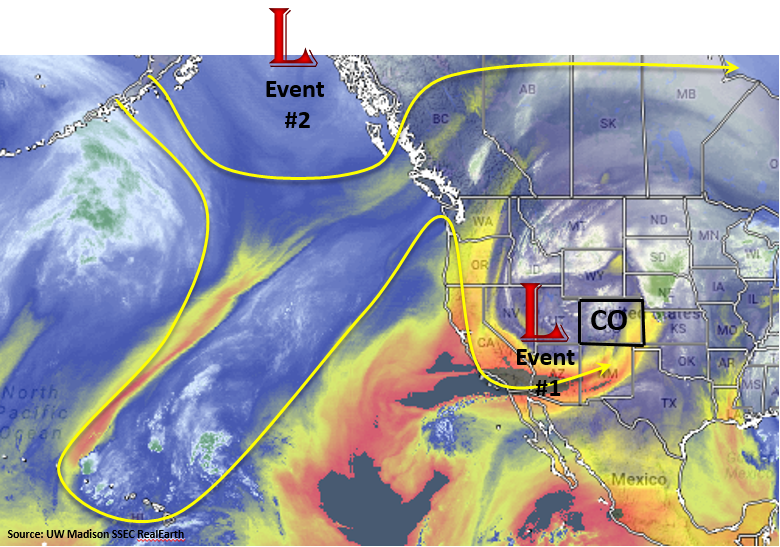
The repetitive pattern will continue for this next 15-day flood outlook. The jet stream this last few weeks has been more summerlike with the core of the jet residing north over the Midwest. The recurring troughs dropping into the Great Basin has also been rather rhythmic. The water vapor imagery below shows the low that has been controlling the weather the last few days (Event #1) and another trough over Alaska (Event #2). This low associated with Event #1 will begin to lift into an open wave to the northeast this afternoon through tomorrow causing severe weather for northeast Colorado. The second trough will begin to move over the west coast Thursday and drop south over the Great Basin. Before this event reaches Colorado Friday, a ridge will build over the state. While the axis of the ridge is to the west and north of Colorado (drying pattern), residual moisture should be ample enough for isolated afternoon mixes of showers and thunderstorms through Thursday. The tough for Event #2 quickly lifts to the northwest by Saturday morning, and in its wake, plus a weak cool front, a ridge begins to build over the state once again. Temperatures will be above average this week and climb into the low 90s for the lower elevations by this weekend under the developing ridge. The warmer temperatures will continue to melt away the snowpack, so rivers will be running high. However, no major riverine flooding is expected through next weekend.
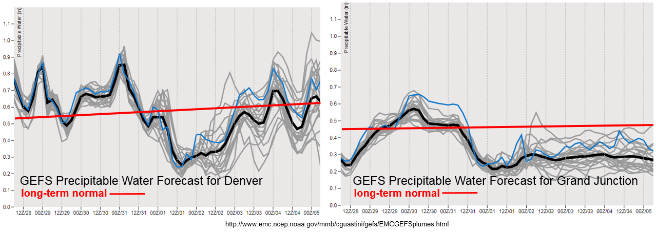
The GEFS Precipitable Water (PW) plume forecast for Denver and Grand Junction shows this above average moisture through Wednesday, before southwest and westerly flow begin to dry out the lower levels and decrease PW. The moisture through Wednesday should be enough for the diurnal heating pattern to excite a mix of isolated mixed showers and thunderstorms. After Wednesday, southwest flow begin to dry out the state and easterly low level flow will struggle to get PW high enough for heavy rainfall. There is one expectation over the Southeast Plains where severe weather and heavy rainfall could organize Wednesday afternoon. Gusty winds and limited rainfall will be likely elsewhere for storms that form towards the end of this week. Monday and Tuesday of next week a trough to the north will help pull some moisture back into eastern Colorado (potential Event #3), but details for heavy rainfall and severe weather potential over the eastern plains is limited at this time. Please check back to Thursday’s FTO as daily events this far out are hard to forecast and are best predicted in 24-hour time frames.
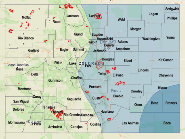
Event #1: Tuesday (5/29)
Elevated Flood Threat as the open wave lifts northwest into the Dakotas and provides extra lift for thunderstorms over the Northeast Plains and Front Range
PW continues to remains high enough for isolated thunderstorm development over the Northern Mountains and Front Range during the afternoon. The storms should be more isolated than Monday, but extra energy remaining from the trough should help support thunderstorm development. Over the eastern plains and Palmer Divide, a few isolated, severe thunderstorms may form along a line of convergence. Higher moisture will allow heavier rainfall, but high accumulation should be limited due to the more isolated nature of the storms and quicker storm motion. However, after two nights of heavy rainfall, increased runoff could cause a flood threat. Confidence of severe thunderstorm coinciding with saturated soils placement is low, so please check back to tomorrow’s FTB.
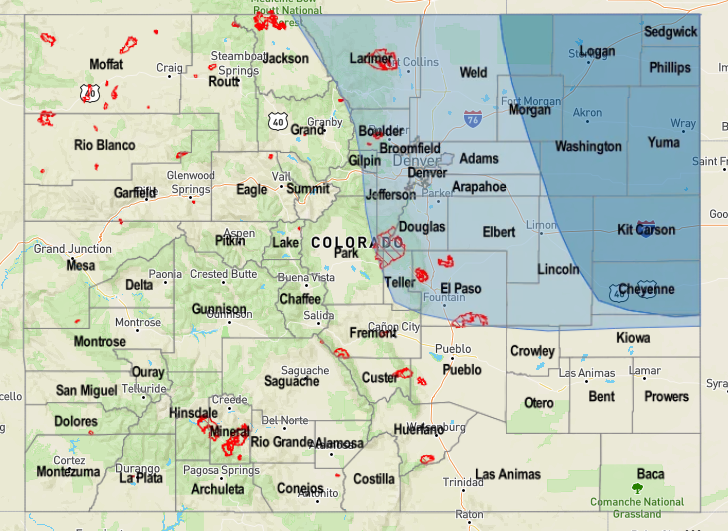

Event #2: Wednesday (5/30) – Thursday (5/31)
No Apparent Threat as the ridge builds and begins to dry out the state
The disturbance that will bring about Event #2 is less about dynamics and more about residual moisture under the building ridge. Expect afternoon showers and thunderstorms to form over the mountains with diurnal flow, but they will be more isolated in nature than Monday and Tuesday. Slower storm motion under the ridge could pair with localized moisture for heavy rainfall, but the more likely outcome is gusty winds under the cores and increased fire danger due to drying southwesterly/westerly winds. Higher PW over the Southeast Plains with southeasterly flow may help trigger a few severe storms along a moisture boundary. Rain rates could exceed 1.5 inches per hour. Please tune back to the daily FTB as details for the forecast will evolve.