Issue Date: Monday, May 28, 2018
Issue Time: 10:45AM MDT
Summary:
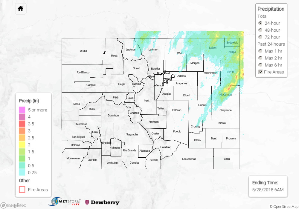
Strong increases in moisture over the eastern plains and Palmer Ridge, thanks to a frontal passage, helped fuel widespread, severe thunderstorms on Sunday. High instability was able to build by the afternoon due to strong daytime heating. Combined with low-level moisture and increased lift from the low over UT/NV, the perfect environment was created for an afternoon and evening of thunderstorms and severe weather. Storms began to fire along the Front Range and Southeast Mountains, by early afternoon and also along the boundary over the Northeast Plains. As the storms that formed over the higher terrain moved northeast into better moisture (55-60F dew points) and instability, they quickly formed into a convective line. Several Severe Thunderstorm Warnings were issued as well as a couple Tornado Warnings, but no tornadoes were reported. Hail up to 1.75 inches was recorded in Yuma County as well as a gust of 58 mph in Akron. Sterling airport received 1.29 inches of rain with radar estimates as high as 1.5 inches. Max 1-hour rain rates were estimated at 3 inches over Kit Carson County, and a lingering MCS continued through 2AM helping generate 24-hour totals of 3.5 inches.
Despite widespread thunderstorm coverage and overnight rainfall, flooding was not reported on Sunday. For rainfall estimates in your neighborhood, scroll down to the State Precipitation Map below.
Click Here For Map Overview
Note: We have identified a possible underestimation in QPE over the southwest part of the state. We are working to on this issue, and will provide an update as soon as possible.