Issue Date: Friday, May 25, 2018
Issue Time: 09:30AM MDT
Summary:
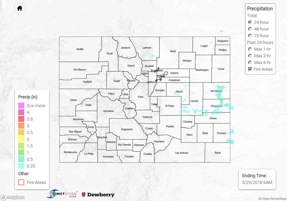
A couple isolated thunderstorms were able to kick off near the Palmer Ridge yesterday afternoon along a weak line of convergence. With moisture limited to the west, due to the building ridge, a strong outflow boundary was produced. The La Junta airport measured this gust at 37 mph. As the isolated thunderstorms traveled east, they moved into 45-50F dew points over Cheyenne and Kit Carson County. This small increase in moisture helped drop some impressive rain totals under the cores of the storms. Radar rainfall estimates were just over 1.5 inches with a CoCoRaHS station SW of Burlington recording 0.49 inches. These storms also produced 1 inch hail in Kit Carson County.
Flooding was not reported on Thursday. For rainfall estimates in your area, scroll down to the State Precipitation Map below.
Click Here For Map Overview
Note: We have identified a possible underestimation in QPE over the southwest part of the state. We are working to on this issue, and will provide an update as soon as possible.