Issue Date: Thursday, May 4th, 2015
Issue Time: 9:00 AM MDT
Summary:
FLOOD WARNINGS/ADVISORIES CONTINUE FOR PORTIONS OF THE CACHE LA POUDRE RIVER, SOUTH PLATTE RIVER, AND SOUTH BOULDER CREEK.
With dry air aloft, it took a fairly substantial amount of moist, upslope flow to provide the fuel for isolated-to-scattered thunderstorms to develop yesterday. The Front Range, Urban Corridor, Palmer Ridge, Northeast Plains, and portions of the Southeast Plains received this influence and in return produced a show of strong-to-severe thunderstorms. Action got started in the mid-afternoon hours over the Front Range, Palmer Ridge and Urban Corridor and winded down overnight across the Northeast and Southeast Plains. The storms produced bouts with moderate-to-heavy rain, large hail, and strong winds. Take a look at the severe storm reports:
1.0 inch hail: Bennett, 5 miles ENE of Centennial, 14 miles SSE of Fort Collins, 2 miles N of Elizabeth, 3 miles WNW of Evergreen, 5 miles E of Parker, SW Arvada, Aurora, 4 miles E of Elizabeth, 1 mile S of Agate, and 3 miles NNE of Larkspur
1.25 inch hail: 5 miles W of Country Gardens, Centennial, Loveland, 3 miles SSW of Elizabeth, 1 mile NW of Louviers, and 3 miles ESE of Perry Park
1.5 inch hail: 5 miles S of Bennett, 8 miles S of Manilla Village, 1 mile NE of Loveland, 2 miles N of Kiowa, 4 miles N of Elizabeth, and 3 miles WSW of Ponderosa Park
1.75 inch hail: 4 miles E of Elizabeth, 3 miles SSE of The Pinery, 3 miles NE of Franktown, 5 miles SE of Parker, 5 miles SE of Franktown, 4 miles NNW of Larkspur, and 3 miles N of Ordway
2.0 inch hail: Elizabeth
2.5 inch hail: 3 miles ENE of Elizabeth
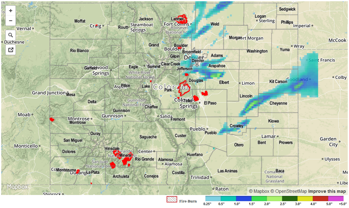
Due to the effects of hail on radar, the radar-estimated STP map below is likely contaminated and shows higher total precipitation than what was actually observed. From CoCoRaHS, these are the highest observed rainfall totals:
Weld County: 1.28 inches
Jefferson County: 0.83 inches
Douglas County: 0.71 inches
Larimer County: 0.64 inches
Arapahoe County: 0.60 inches
No flash flooding was reported yesterday.