Issue Date: Monday, May 21, 2018
Issue Time: 10:15AM MDT
Summary:
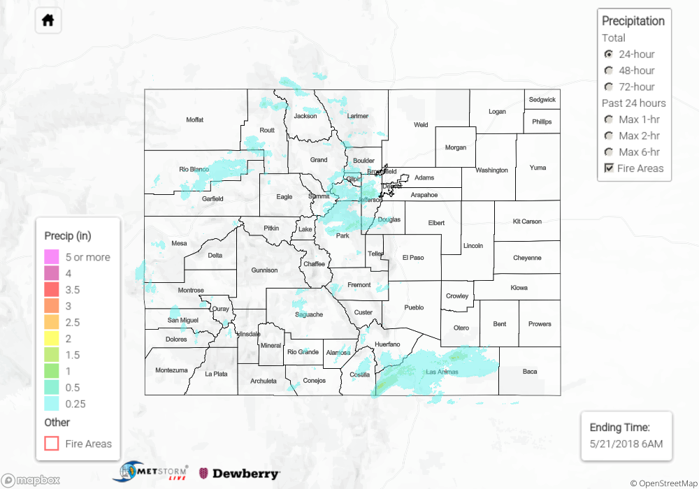
The shortwave noted in the water vapor imagery yesterday (see FTB) helped trigger widespread showers and thunderstorms across the higher elevations by early afternoon on Sunday. More moisture was present over eastern Colorado, so with the help of the atmospheric dynamics, showers and thunderstorms kicked off by late in the morning. This brought some relief to the dry weather, but limited moisture caused more gusty winds than much needed rainfall. Both Montrose and Meeker airports reported gusts just above 50 mph due to the dry layer in the region. As far as rainfall totals, the highest reporting CoCoRaHS stations in the region were up to 0.1 inches with radar estimates a bit higher at 0.25 inches. Elsewhere, the southern Front Range and Urban Corridor, along with the Southeast Mountains, got some more rain to help with the spring green-up. Estimates by radar were up to 1 inch over the Raton Ridge with a couple SNOTEL stations near Breckenridge reporting 0.3 inches. No flooding was reported on Sunday.
On another note, the Yampa, Elk, Gunnison and Colorado Rivers have likely reached their peak flows for the season. The Yampa peak streamflow was measured at 2,570 cfs putting it at its lowest peak since 2012. The Elk is sitting around 1,570 cfs. Combined, the Gunnison and Colorado rivers had the third earliest peak recorded with 8,500 cfs. This puts the Gunnison and Colorado rivers at the fourth lowest peak streamflow ever recorded.
For rainfall estimates in your neighborhood on Sunday, scroll down to the State Precipitation Map below.
Click Here For Map Overview
Note: We have identified a possible underestimation in QPE over the southwest part of the state. We are working to on this issue, and will provide an update as soon as possible.