Issue Date: 5/20/2018
Issue Time: 12:10 PM
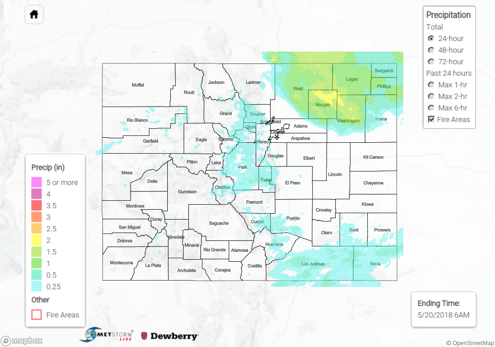
Summary:
Moisture from the Friday night/Saturday morning impulse continued to wrap back into northeastern parts of the state on Saturday morning. Areas along and northeast of a Wellington-Greeley-Last Chance line received at least 0.25” of rain on Saturday, mostly in the form of showers and drizzle that persisted until around mid-day. The top rainfall reports for the day were almost all from the northeast corner, with the exception of one station in Routt County on the western slope:
• 1.76” at Fleming 6.6 S (Logan Co.)
• 1.29” at Oak Creek 4.7 E (Routt Co.)
• 1.18” at Hillrose 1.2 NE (Morgan Co.)
• 1.12” at Akron (Washington Co.)
• 1.08” at Hillrose 2.5 SSW (Morgan Co.)
Spotty showers also occurred across the high terrain in essentially all parts of the state except the San Juan Mountains, but rainfall totals were generally light (0.25” or less). A few thunderstorms tracked across the Southeast Plains and Raton Ridge as well, producing pockets of 0.25” – 0.75” of rain across Las Animas and Baca counties.
Flooding occurred just north of the border in southeastern Wyoming and western Nebraska, but was not reported in Colorado on Saturday. For rainfall estimates in your area, check out our State Precipitation Map below.
Click Here For Map Overview
Note: We have identified a possible underestimation in QPE over the southwest part of the state. We are working to on this issue, and will provide an update as soon as possible.