Issue Date: Wednesday, May 16th, 2018
Issue Time: 9:30 AM MDT
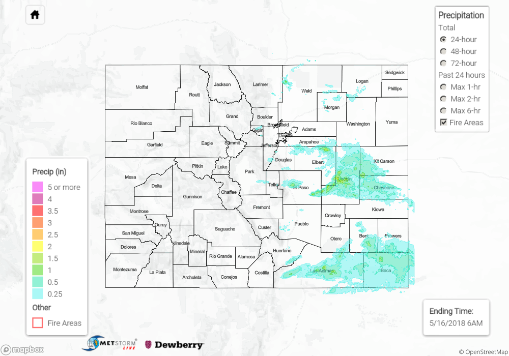
Summary:
The upper-level low finally began to break down and ejected a shortwave disturbance that passed overhead yesterday. This disturbance worked in concert with daytime heating and orographic support to drive the development of isolated-to-scattered thunderstorms along/east of the Front Range/Southeast Mountains and over the plains. The bulk of activity occurred during the afternoon/evening hours yesterday, but a few storms were able to keep chugging along into the early morning hours. Storms over the lower elevations of the Urban Corridor (south of Douglas County) and Southeast Plains were the most efficient rainfall producers thanks to having access to deeper moisture than those to the north. The largest hail report of the day came from 1 mile SW of Atwood (Logan County) where 1.75 inch diameter hail was observed by a trained spotter. According to CoCoRaHS observers, the big winners for rainfall are as follows:
El Paso County: 1.33 inches
Otero County: 1.21 inches
Cheyenne County: 0.85 inches
Prowers County: 0.72 inches
Flash flooding was not reported yesterday. For a look at precipitation estimates in your area, please see our State Precipitation Map below.
Click Here For Map Overview
Note: We have identified a possible underestimation in QPE over the southwest part of the state. We are working to on this issue, and will provide an update as soon as possible.