Issue Date: Monday, May 14, 2018
Issue Time: 10:30AM MDT
Summary:
Sunday was another day of cool temperatures and wet weather for the northeast portion of the state. Elsewhere in the lower elevations, it remained quiet dry with pleasant temperatures in the mid-70s and low 80s. Midday clearing and a passing upper level disturbance combined to form several thunderstorms over the Front Range and Palmer Ridge that moved into the Urban Corridor. Another set of storms formed over the Northeast Plains along a line of convergence. With low freezing levels, large hail was reported with the thunderstorms, and the storm just north of Elizabeth produced hail 1.5 inches in diameter. While not the strongest storm, the most impactful storm passed over DIA late last night and produced 0.75 inch hail. This hail caused damage to several planes, which in turn lead to cancellations this morning. Max 1-hour rain rates were estimated at 1 inch with storm totals up to 1.5 inches.
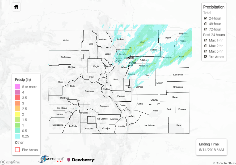
Despite the hail and heavy rainfall, no flooding was reported Sunday. For an estimate of rainfall totals in your area, scroll down to the State Precipitation Map below.
Click Here For Map Overview
Note: We have identified a possible underestimation in QPE over the southwest part of the state. We are working to on this issue, and will provide an update as soon as possible.