Issue Date: Sunday, May 13th, 2018
Issue Time: 10:47 AM MDT
Summary:
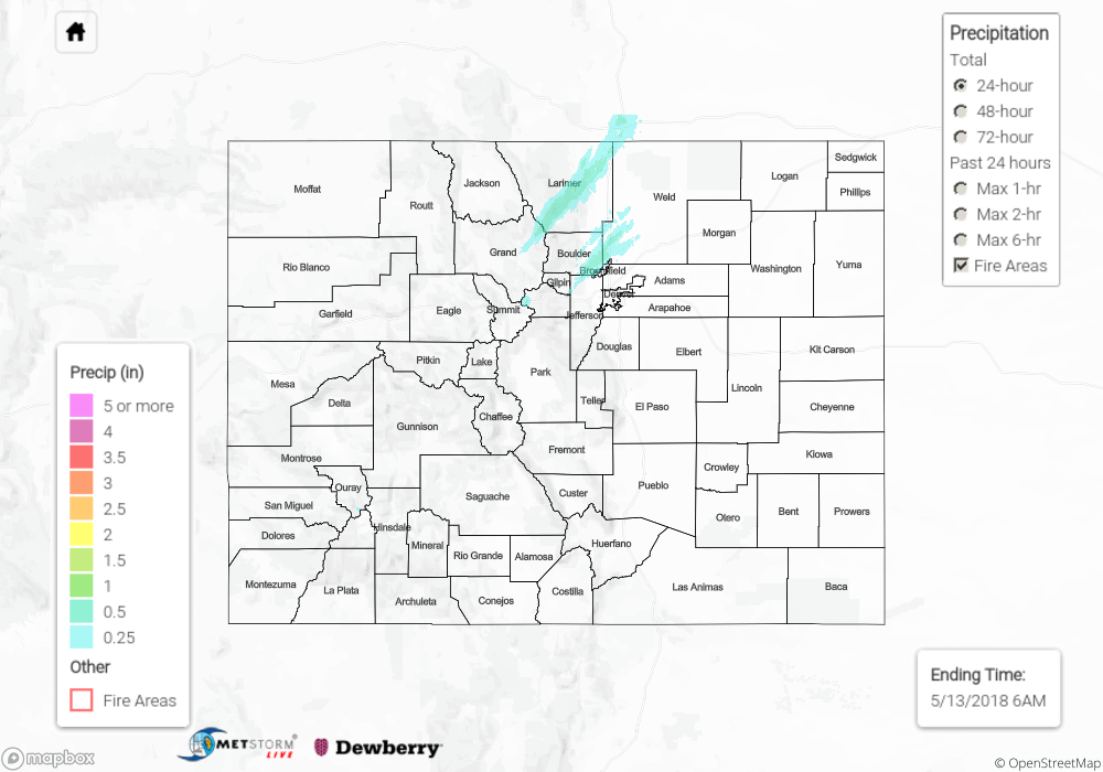
Yesterday was dry for many across the state, as southwest flow around the large upper-level low to the west ushered in warm, dry air to the high country and western slopes. Northeastern portions of the state began the day under fog and low stratus, with drizzle and light rain along the foothills and urban corridor producing a widespread 0.10” to 0.50” of rain (see 24-hour CoCoRaHS totals below). By midday, some lifting and clearing of the cloud layer allowed some instability to build, and this instability was tapped by a mid-level shortwave that moved through CO over the course of the evening. Two main small bands of thunderstorms were the result, with one setting up over central and northeastern Larimer County and another near Longmont. These locations were the big winners for precipitation across the state yesterday, with a few locations around 1”.
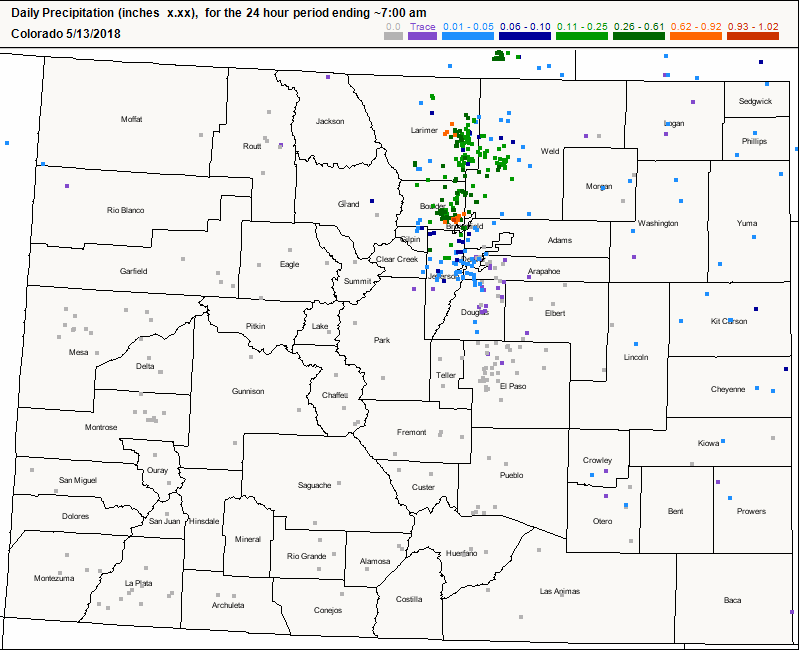
Flash flooding was not reported yesterday. For a look at precipitation estimates in your area, please see our State Precipitation Map below.
Click Here For Map Overview
Note: We have identified a possible underestimation in QPE over the southwest part of the state. We are working to on this issue, and will provide an update as soon as possible.