Issue Date: 5/9/2018
Issue Time: 9:45 AM
NO FLOOD THREAT IS FORECAST TODAY.
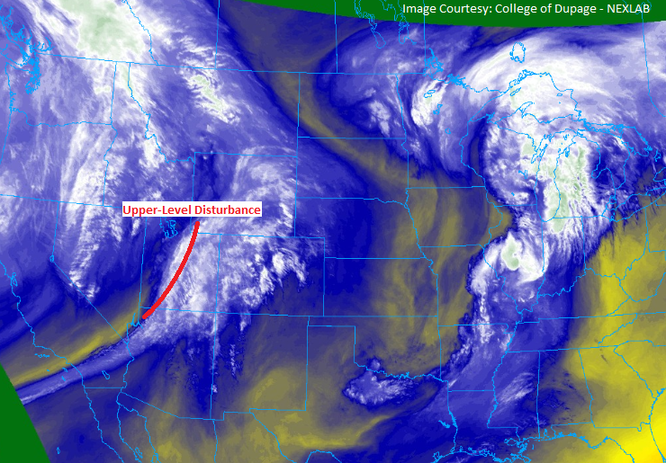
The high-pressure ridge that was in control yesterday will remain in control today, but there’s a new player in today’s forecast. A weak, upper-level disturbance, and associated moisture, (highlighted in the water vapor image below) will push into the state from the west, kicking of isolated showers/thunderstorms as it traverses Colorado. These storms will produce little in the way of rainfall, as low-level moisture continues to lack across much of the state. The exception to this will be across the eastern Plains, along and east of a line from Hereford-to-Brush-to-Kim, where dewpoints in the upper-30s/low-40s will hang on long enough to allow for brief shots of wetting rain underneath isolated thunderstorms. For more details on timing and rain rates, please see the zone-specific forecast discussions below.
Today’s Flood Threat Map
For more information on today’s flood threat, see the map below (hover over threat areas for more details). For Zone-Specific forecasts, jump below the map.


Zone-Specific Forecasts
Urban Corridor, Palmer Ridge, Northeast Plains, Southeast Plains, and Raton Ridge:
Warm and dry conditions will be the name of the game for most locations today, with only a few isolated thunderstorms rumbling during the afternoon/evening. Low-level moisture continues to lack across the area, so rainfall rates will be limited. The best chance for wetting rains will be east of a line from Hereford-to-Brush-to-Kim where dewpoints in the mid-30s/low-40s will hang on. Generally speaking, the main threat from storms will be gusty winds and lightning, with plenty of virga and only brief periods of rainfall. Maximum rain rates will be 0.05-0.15 inches/hour over the Urban Corridor, Palmer Ridge, and Raton Ridge, with maximum rain rates over the Northeast and Southeast Plains of 0.25-0.5 inches/hour.
Timing: 2 PM – Midnight
Front Range, Northern Mountains, Northwest Slope, Central Mountains, Grand Valley, San Juan Mountains, Southeast Mountains, San Luis Valley, and Southwest Slope:
Increasing clouds and warm temperatures will be the main weather story today, as upper-level moisture streams over the area. A couple isolated, high-based showers and thunderstorms will develop during the afternoon/evening over the higher terrain as the disturbance passes overhead. The main impacts will be plenty of virga, gusty winds, and some lightning, but very little rainfall. Expect nothing more than a sprinkle or two, with the best rain rates that any thunderstorm can produce being 0.05-0.1 inches/hour.
Timing: 11 AM – 10 PM