Issue Date: Monday, May 7, 2018
Issue Time: 2PM MDT
Valid Dates: 5/8 – 5/22
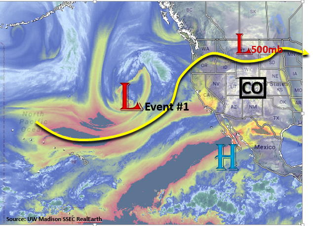
The upper level disturbance that is currently affecting the state can be seen over Montana in the water vapor imagery below. This will continue move through the state this afternoon and beginning tomorrow, the visible ridge over the west coast will begin to build. This will bring warm and dry weather to the state the next couple of days before arrival of the next system. Event #1 is associated with the large scale disturbance over the Pacific that will continue to march eastward the next couple of days. Currently, the trough is forecasted to dig south into Utah and Arizona and produce an unsettled weather pattern over the state beginning Thursday. After this trough moves out of the state Sunday, a quieter, more zonal and ridging pattern sets up for the remainder of next week. Models are hinting at another large scale disturbance (Event #2) moving through the area at the end of this Outlook; however, it is essential to stress this may change. Currently, the rainfall for Event #2 is projected to fall over the higher terrains and eastern plains.
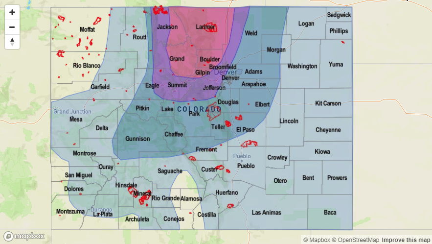
Later this week, moisture levels will begin to rise with the approaching trough. By Thursday, an increase in moisture, paired with shortwaves, will help trigger isolated thunderstorms over the higher terrain and eastern plains. By Friday afternoon, PW is expected to be in the 0.6-0.7 inch range west of the Continental Divide, and east of the Divide, PW values will increase to 0.8 inches over northern Urban Corridor and Northeast Plains. The upper level dynamics and increased moisture will produce showers nearly statewide, but the greatest rainfall totals will be confined to the northern high terrains and Northeast Plains. The best chances of heavy rainfall and flooding will occur from Friday afternoon into Saturday. Below we describe the two identified precipitation events in more detail.
Event #1: Thursday (5/10) – Sunday (5/13)
Elevated/No Apparent Threat as increased moisture pairs with a trough for a rain-filled weekend
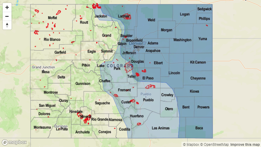
Moisture returns to northeast Colorado and the far eastern plains later this week. This event will begin with isolated thunderstorms over the high terrains and Northeast Plains Thursday. Friday into Saturday, expect showers to increase in coverage and intensity. The best chances for heavy rainfall totals will be over the northern high terrains and Northeast Plains. 1-hr rain rates will generally be around or under 0.1 inches with stronger storms producing rates up to 0.25 inches/hour. West of the Continental Divide, higher rainfall totals will be confined to the mountains, though more limited rainfall should occur in the valleys. Snow will be likely at elevations above 9,500 feet with the snowline decreasing in elevation Saturday night. Similar to the last storm, this will provide a much needed soaking for the ground due to low snowpack this last winter. Unfortunately, the event won’t do much to alleviate the growing drought over southern Colorado.
Event #2: Friday (5/18) – Monday (5/21)
No Apparent Threat as another trough approaches the state from the west
The ridging pattern begins to break down again towards the end of next week brining more rainfall to the state. Currently the GFS is forecasting a trough moving into the Great Basin from the west coast. Moisture appears to only be present east of the Continental Divide, which is normal for this time of year. Confidence is low at this time, but the rainfall will likely affect the Front Range, Southeast Mountains and eastern plains. Stay tuned to the future FTOs as details will likely change.


