Issue Date: Friday, May 4th, 2018
Issue Time: 9:30 AM MDT
Summary:
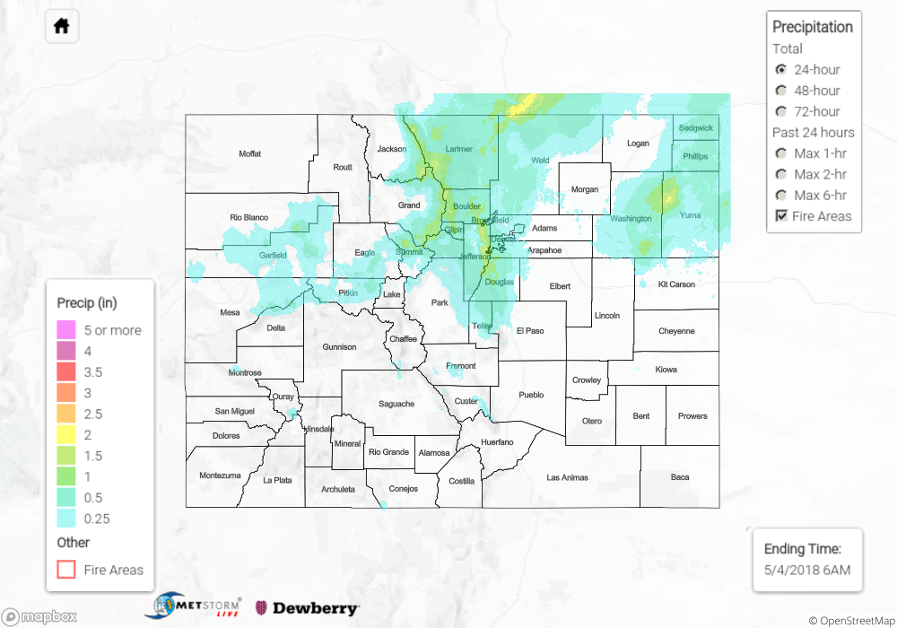
The exiting low-pressure system provided one more day of scattered rainfall across the state, even allowing portions of the Southeast Mountains, Raton Ridge, and Southeast Plains to pick up on some much needed, even if too little, moisture. Elsewhere, the Northeast Plains and Urban Corridor continued to be the big winners of the state, as the best moisture and upper-level support existed there. A swath of 0.5-1.0 inch of rainfall, with locally higher amounts, impacted the Urban Corridor from Denver to the WY state line.
Out west over the High Country, scattered showers/thunderstorms dotted the higher elevations and lower valleys, with snow levels meandering between 7000 and 8000 feet. Heavy snow was reported across the higher elevations, with some locations picking up on more than 6” of snow.
Flash flooding was not reported yesterday. For a look at precipitation estimates in your area, please see our State Precipitation Map below.
Click Here For Map Overview
Note: We have identified a possible underestimation in QPE over the southwest part of the state. We are working to on this issue, and will provide an update as soon as possible.