Issue Date: Tuesday, May 1st, 2018
Issue Time: 9:15 AM MDT
Summary:
Mother Nature must have gotten the word that the 2018 FTB was about to kick off, as she welcomed the new season with scattered showers across portions of the western slope and scattered showers/thunderstorms across Northeast Colorado. Across the western slope, showers were garden variety, moving fairly slowly with low rain rates. Showers continue this morning across portions of the Grand Valley, Northwest Slope, and Southwest Slope regions, though this activity is resulting in mainly virga with little precipitation reaching the surface.
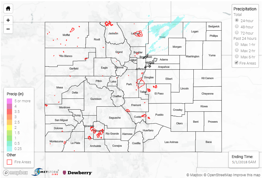
It was a slightly different story across Northeast Colorado, where better instability and moisture resided, resulting in scattered showers/thunderstorms that impacted portions of the Front Range, Urban Corridor, and Northeast Plains. This activity mainly occurred during the afternoon and evening hours, with nearly all activity dissipating by midnight. While moisture was good enough to produce thunderstorms, it was still too low to result in heavy rain, with gusty winds and periods of light-to-moderate rainfall as the main impacts. A few light showers continued into the early morning hours, resulting in little additional rainfall. One lonely severe storm report was logged during yesterday’s activity: 1.25 inch diameter hail was reported 1 mile SSW of Fort Lupton (Weld County). Weld County was also the rainfall winner yesterday, with one CoCoRaHS report of 0.45 inches near Briggsdale. Most locations, though, received less than 0.1 inches of rainfall.
Flash flooding was not reported yesterday. For a look at precipitation estimates in your area, please see our State Precipitation Map below.
Click Here For Map Overview
Note: We have identified a possible underestimation in QPE over the southwest part of the state. We are working to on this issue, and will provide an update as soon as possible.