Issue Date: Tuesday, September 12, 2017
Issue Time: 11AM MDT
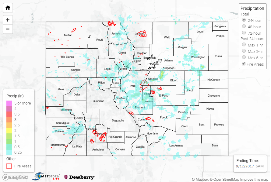
Summary:
A weak disturbance and above normal moisture content was enough to increase thunderstorm coverage across Colorado on Monday. As is frequently the case, the vast majority of storms were garden variety, producing a few tenths of an inch of range over most of the High Country and adjacent foothills above about 7,000 feet. However, a few storms stood out from the rest. The storm of the day was likely in western Elbert County, where a quick 1 inch of rain fell in less than 30 minutes. Radar-enhanced estimates suggest up to 2 inches of rain fell in 1 hour. Another area of enhanced rainfall activity was in Chaffee County where up to 1.5 inches of rain fell in about 1 hour or less. West of the Continental Divide, rainfall amounts were lower with up to 0.6 inches falling mainly over the higher elevations of the San Juans. Small hail was reported in Routt County, south of Steamboat Springs from a small cell during the late afternoon hours.
Flooding was not reported on Monday. For rainfall estimates in your area, check out our State Precipitation Map below.
Click Here For Map Overview
Note: We have identified a possible underestimation in QPE over the southwest part of the state. We are working to on this issue, and will provide an update as soon as possible.