Issue Date: Monday, September 11, 2017
Issue Time: 10:30AM MDT
Summary:
Increase moisture from southwest and westerly flow continued to fuel the daily rounds of thunderstorms over the higher terrains. More shortwave energy from the west coast trough also made it into the state yesterday increasing coverage over the mountains. This extra energy also helped a few showers linger overnight. Storms began to fire over the mountains around 1PM and favored the northern portion of the state as well as the Southeast Mountains. Storm bases were still quite high, which limited rainfall totals, but more rain reached the surface than the prior days. As the storms moved off the mountains, they favored the Cheyenne and Palmer Ridges.
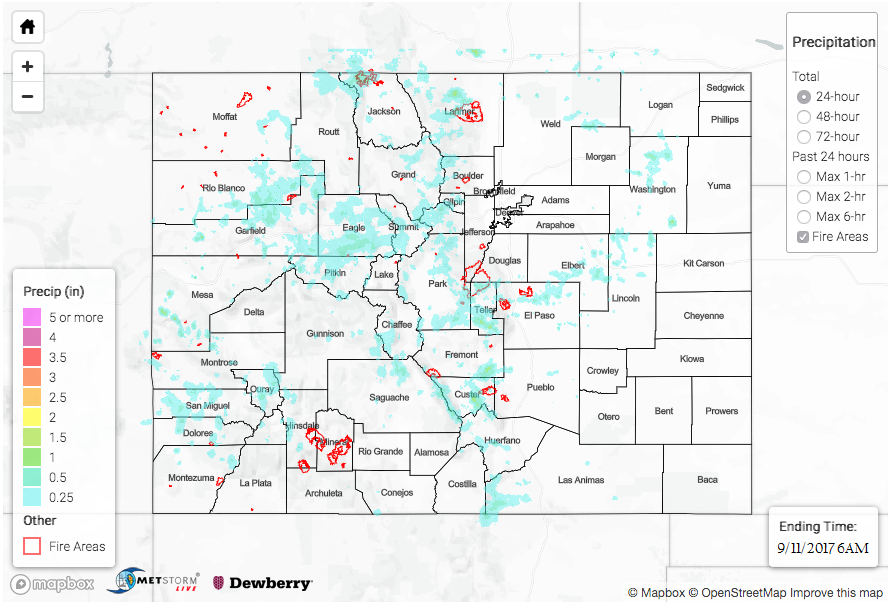
A couple of SNOTEL stations over the mountains recorded up to 0.7 inches. One of these stations was in the San Juan Mountains where storms were more isolated in nature yesterday. Over the Front Range, in Teller County, a CoCoRaHS station recorded 0.76 inches with radar rainfall estimates up to 1 inch. There were two areal flood advisories for Custer County near the Junkins Burn Scar. Luckily no flooding was reported. Radar rainfall estimates were just over 1 inch in this area. Most storms that moved off the higher terrains into the plains were short-lived with rainfall estimates just over 1 inch.
As of Monday morning, there was no flooding reported. For rainfall estimates over your area, take a look at the State Precipitation Map below.
Click Here For Map Overview
Note: We have identified a possible underestimation in QPE over the southwest part of the state. We are working to on this issue, and will provide an update as soon as possible.