Issue Date: Thursday, September 7, 2017
Issue Time: 12PM MDT
Valid Dates: 9/8 – 9/22
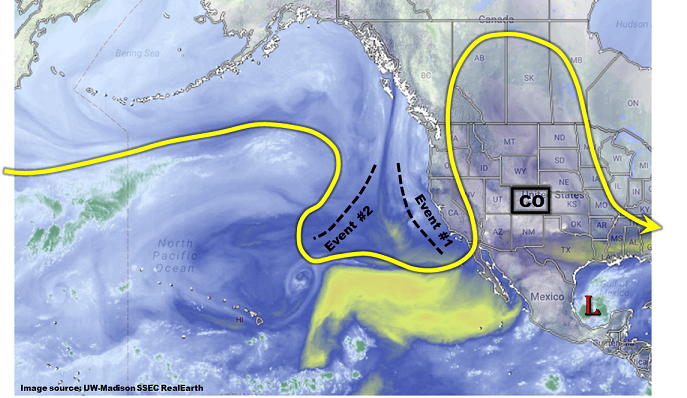
A high-amplitude jet stream is seen this morning across western North American with a large upper-level ridge over the Great Plains and a trough off the coastline. Within the trough are two embedded disturbances, or shortwaves, that will be the main features controlling Colorado’s weather over the next 7-10 days. Two precipitation events have been identified for the 15-day Outlook, corresponding to each shortwave. The first event will be mainly light to moderate precipitation as low-level moisture remains marginal. The second event, while more uncertain because the shortwave is expected to cut off from the main flow, has more potential to cause heavier rainfall due to a supply of higher moisture content available for it to draw from.
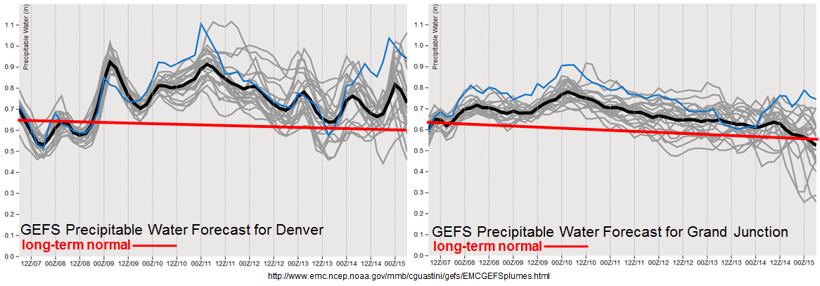
As shown in the forecasted Precipitable Water plumes, below, moisture content is expected to remain at or above seasonal normal through the majority of the next 10 day period. However, seasonal “normal” is entering a period of rapid decline. For example, at Denver, normal PW decreases by about 5% every week during September and October. Thus, above normal does not have the same impact as it did during July and August. Nonetheless, note that during Event #2, there is a potential to approach PW of 1 inch, which combined with other factors, can cause heavy rainfall east of the Continental Divide. To the west, it is looking more likely that the Southwest monsoon may be waning, at least for Colorado. Monsoon surges continue in Arizona, but moisture is not expected to make it far enough north to support heavy rainfall across the Western Slope, even over the climatologically favored San Juans.
Below we describe each of the two identified precipitation events in more detail.
Event #1: Friday (9/8) through Sunday (9/10)
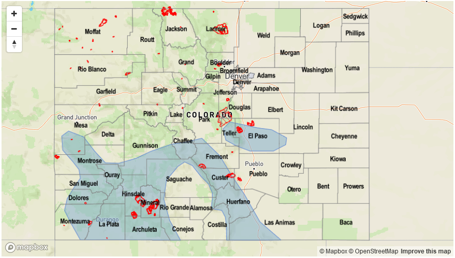
No Apparent Flood Threat but increase in PM showers and weak storms likely for San Juans
A weak shortwave will approach Colorado from the west, causing a slight increase in rainfall coverage mainly across the San Juan mountains. Daily round of storms could produce up to 0.5 inches per hour of rainfall, locally, with up to 1 inch could fall over the entire period of the Event. However, flooding is not expected. Furthermore, storm coverage outside of the San Juans is expected to be rather limited.
Event #2: Wednesday (9/13) through Friday (9/15)
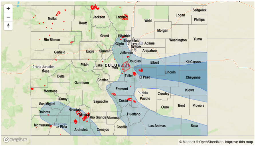
Brief Elevated Flood Threat as cut-off low finally moves east
Despite a considerable amount of uncertainty remaining regarding timing, it does appear that the expected cut-off low will move eastward out of the eastern Pacific early next week. The system will move slow enough to allow for moisture return across most of Colorado. An increase in afternoon and evening shower and storm activity is expected over the San Juans, Southeast Mountains, Raton Ridge and Palmer Ridge. Currently, it appears that Thursday could have a brief Elevated flood threat as the main disturbance moves overhead. With Precipitable Water values as high as 1 – 1.1 inches east of the Continental Divide, isolated heavy rainfall up to 1.7 inches per hour (east) and 1.2 inches per hour (west) could be possible. Fire scars in the Southeast Mountains will need to be watched since even 0.5 inches of rain per hour could cause excessive runoff.


