Issue Date: Wednesday, September 6, 2017
Issue Time: 10:00AM MDT
Summary:
Much cooler temperatures yesterday for the eastern portion of the state with the passage of a cold front Monday night. High temperatures yesterday were 15-20F cooler than Monday with the eastern plains reaching the mid-70s. Overnight lows were around 40F (east) and 30F (west). Over the western portion of the state, temperatures remained warm. The shallow cold front was not able to move over the Continental Divide, and highs in the Grand Valley were in the mid-90s. There was a reduction in haze at the low-levels yesterday for the eastern portion of the state with the cold front passage. However, smoke continued to be advected into the state with the high pressure to the west. The northwest corner of the state had visibility limited to a 6 mile range during the afternoon with haze also reported in the mountains.
Dry air and cooler, stable east limited convection to light showers over the mountains yesterday. A couple SNOTEL stations recorded 0.2 inches over the higher terrains. Radar rainfall estimates over the San Juan Mountains were only 0.25 inches. There was no flooding reported Tuesday.
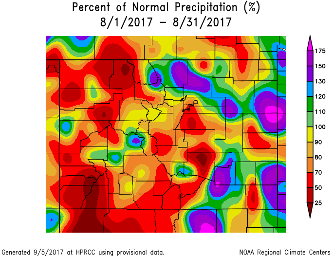
Below is a look at the percent of normal precipitation for the month of August across Colorado. The eastern plains, northern Front Range and Central Mountains all received above normal precipitation. Aligned with climatology, the Wet Mountains also received above average precipitation. The majority of the western portion of the state was abnormally dry for August including the climatologically favored region of the San Juan Mountains.
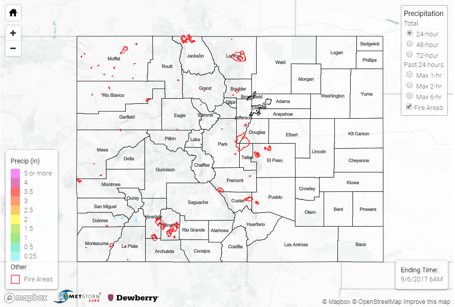
To see if rain fell in your area, scroll down to the State Precipitation Map below.
Click Here For Map Overview
Note: We have identified a possible underestimation in QPE over the southwest part of the state. We are working to on this issue, and will provide an update as soon as possible.