Issue Date: Sunday, September 3, 2017
Issue Time: 9:15AM MDT
Summary:
The first day of intense heat from the Labor Day Weekend heat wave is in the books as a high pressure ridge allowed for plenty of sunshine (for most) on Saturday. The end result was temperatures 5-10F above normal statewide. High temperatures in the mid-90s F were common across southeast and western Colorado. Interestingly, in the northeast part of the state, despite plenty of sunshine, temperatures were likely limited by the thick haze from the numerous wildfires burning to our northwest.
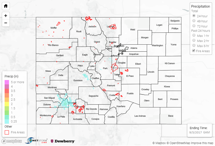
Nonetheless, despite seemingly low odds because of marginal moisture, isolated to widely scattered storms managed to form in the Central Mountains, southern Front Range, San Juans and Southeast Mountains. This is an excellent example of how high elevation terrain can drive its own circulation. As expected, storms had a difficult time producing rainfall and the highest totals this morning were a few tenths of an inch. Interestingly, it appears that a storms combined to form a localized circulation over the San Juans that kept producing light rain showers after sunset (see Saturday evening’s water vapor image, below).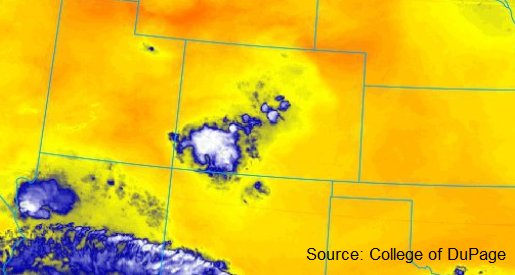
Flooding was not reported on Saturday. For rainfall estimates in your area, check out our State Precipitation Map below.
Click Here For Map Overview
Note: We have identified a possible underestimation in QPE over the southwest part of the state. We are working to on this issue, and will provide an update as soon as possible.