Issue Date: Saturday, September 2, 2017
Issue Time: 9:48AM MDT
Summary:
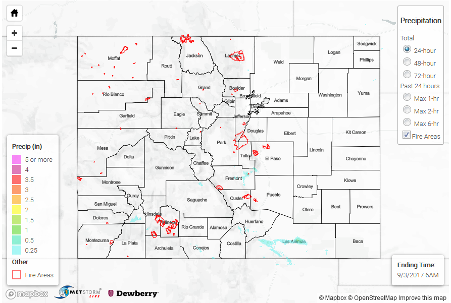
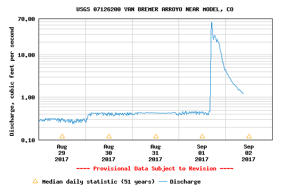
A disturbance trekked quickly across Colorado on Friday, produces a lot of clouds but only limited rainfall. Most of the rainfall occurred in the form of thunderstorms, focused over the climatologically favored Southeast Mountains, Raton Ridge and San Juan Mountains. Storms made the most of the marginal moisture and a few produced rainfall rates up to about 1.2 inches per hour over Las Animas County and up to 0.7 inches per hour over Conejos County. In Las Animas County, the heavy rainfall fell in close proximity to a few USGS gages and a quick streamflow spike from less than 1 c.f.s. to 60 c.f.s. was noted on the Van Bremer arroyo (see below).
The disturbance also knocked down the afternoon high temperatures closer to seasonal normal west of the Continental Divide. Though, as described in today’s Flood Threat Bulletin, this respite was only temporary.
Flooding was not reported on Friday. For rainfall estimates in your area, check out our State Precipitation Map below.
Click Here For Map Overview
Note: We have identified a possible underestimation in QPE over the southwest part of the state. We are working to on this issue, and will provide an update as soon as possible.