Issue Date: Thursday, August 31, 2017
Issue Time: 12:20PM MDT
Valid Dates: 9/1-9/15

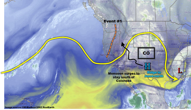
The afternoon’s water vapor imagery, below, shows a disturbance has finally penetrated the previously impressive upper-level ridge. This disturbance will cross Colorado on Friday, bringing widespread shower and storm activity statewide. This is identified as Event #1 in today’s 15-day Flood Outlook. However, the ridge will not cede its ground that easily, and will return with a vengeance over the weekend. High temperatures up to 15F above normal are likely statewide with a few lower elevation locations likely to top 100F. For reference, here are the latest dates that long-term Colorado weather stations have recorded a 95F reading:
- Alamosa – July 5 (only happened once),
- Colorado Springs – September 17,
- Denver – September 19,
- Pueblo – September 25 (though 94F has been observed as late as mid-October), and
- Grand Junction – September 18.
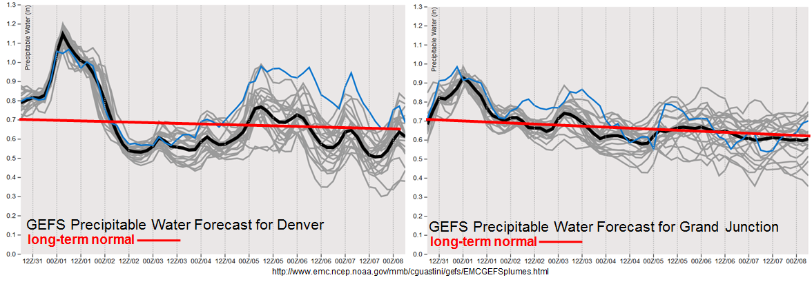
The upper-level ridge re-establishment will be temporary as a strong fall cold front will race southward out of Canada starting Monday. The frontal passage, identified as Event #2, will cause in increase in shower and storm coverage. However, as shown in the forecasted Precipitable Water plumes, below, we do not foresee a heavy rainfall threat due to limited moisture and quick storm motion. Thereafter, a slow decrease in available moisture will limit heavy rainfall chances, as well as precipitation in general.
Below we describe each of the two identified precipitation events in more detail.
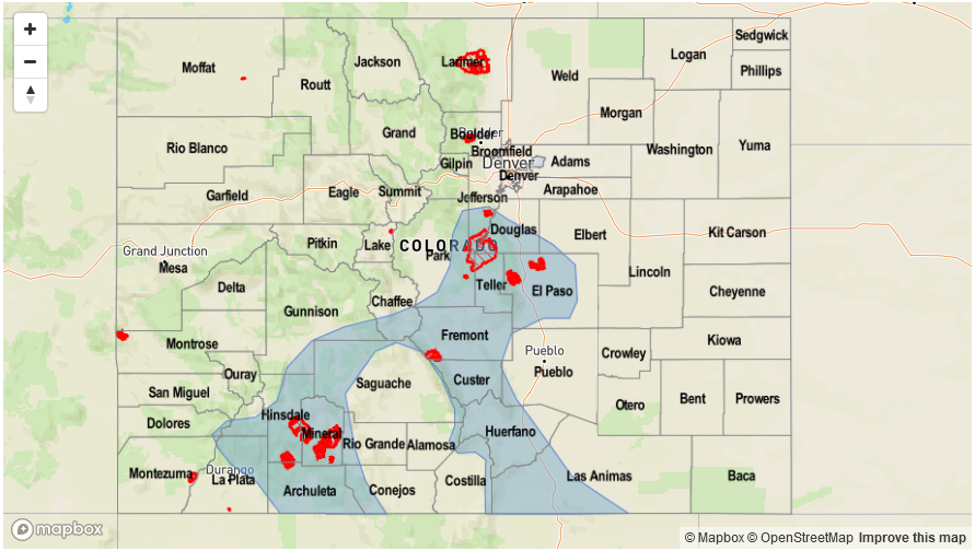
Event #1: Friday (9/1)
Low-end Elevated Flood Threat as shortwave moves across Colorado
A shortwave will continue moving across Colorado on Friday, temporarily increasing rainfall coverage and intensity. Afternoon and evening showers and thunderstorms are expected. Highest coverage will be in the foothills east of the Continental Divide, though some activity will make it farther east especially in the Southeast Plains. With the upper-level support, scattered thunderstorms are also expected across the eastern plains. A severe threat, mainly for large hail, will accompany the isolated heavy rainfall. Max 1-hour rainfall up to 1.1 inch (west) and 1.5 inch (east) can be expected. These rates are right at flood threat intensity and a low-end flood threat is expected mainly for isolated flash flooding. The most vulnerable areas are likely to be burn scars in the Southeast Mountains (Junkins, Beulah Hill, Hayden Pass).
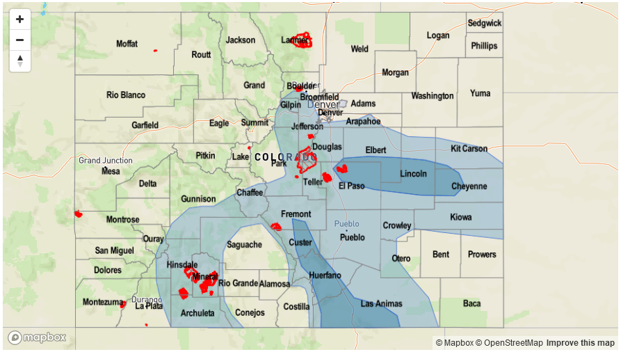

Event #2: Monday (9/4) through Wednesday (9/6)
No Apparent Flood Threat as front passage likely, but return moisture limited
Guidance is in excellent agreement today regarding the passage of a strong fall-like cool front starting on Monday, 9/4. An increase in rainfall coverage is expected mainly east of the Continental Divide. However, moisture will be limited, and showers and the main precipitation type. Isolated thunderstorms remain a possibility and it is not impossible that a low-end flood threat will develop as the amount of moisture becomes more certain. The best chances of precipitation exceeding 0.5 inches will be in south-central Colorado.