Issue Date: Thursday, August 31, 2017
Issue Time: 9:50AM MDT
Summary:
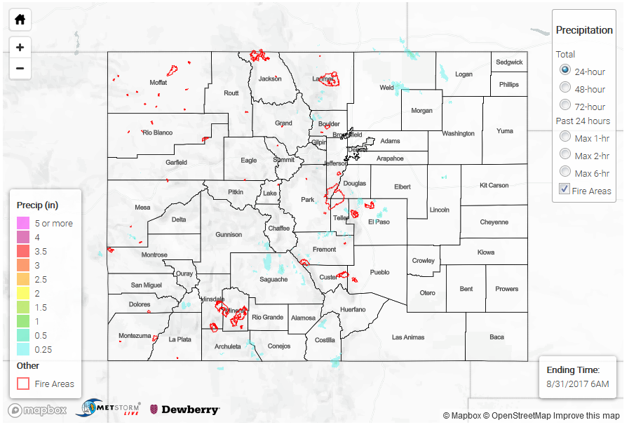
Afternoon and evening shower and storm activity was once again mainly limited to the High Country and nearby foothills where instability was greatest. With marginal moisture available for thunderstorms, rain rates were again limited, though a few storms produced short-term heavy rainfall. CoCoRaHS observers in Larimer, Fremont and Arapahoe counties noted just over 0.75 inches of rainfall, occurring in about an hour or less. Radar supplemented estimates suggest up to 1.5 inches over Morgan County, and up to 1 inch in Custer County. A cluster of storms moved across the Hayden Pass burn scar in the late afternoon, prompting a Flash Flood Warning. Western and eastern portions of the burn scar were estimated to have received 0.25 to 0.5 inches of rain. Fortunately, flooding was not reported.
A local storm report of gusty winds was received in Gunnison County, likely associated with a thunderstorm’s rain cooled downdraft.
The increased cloud cover caused a slightly downtick in afternoon high temperatures, though readings up to 10F above average were still observed west of the Continental Divide.
Flooding was not reported on Wednesday. For rainfall estimates in your area, check out our State Precipitation Map below.
Click Here For Map Overview
Note: We have identified a possible underestimation in QPE over the southwest part of the state. We are working to on this issue, and will provide an update as soon as possible.