Issue Date: Thursday, August 17, 2017
Issue Time: 3PM MDT
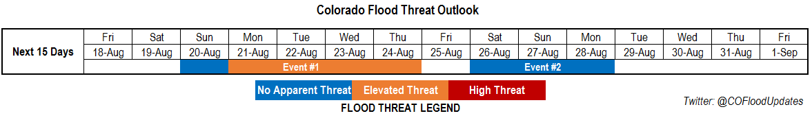
Valid Dates: 8/18-9/1
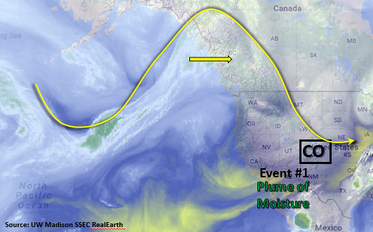
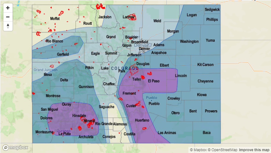
After a very short break, a more active weather pattern is on its way to Colorado once again. As seen on the water vapor image, below, a strong upper-level ridging pattern will establish itself north of Colorado over next couple of days. A mid-level trough will also separate from the main flow and set up over Southern California early next week. With a secondary upper-level high pressure ridge over eastern Texas and the trough over southern CA, a plume of monsoon moisture will start to be pulled into the state. The low-level moisture combined with slow steering winds under the ridge will bring an elevated flood threat to Colorado starting at the beginning of next week.
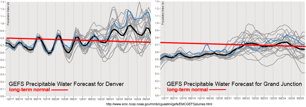
As shown in the forecasted Precipitable Water (PW) plumes below, the moistening begins in earnest on Monday for both Denver and Grand Junction. The higher PW on both sides of the Continental Divide is expected to reach its maximum in the middle of next week. PW could reach as high as 1-1.4 inches statewide, but there is still quite a bit of uncertainty regarding just how high PW will get at this point. The overall setup is similar to our past few weeks, which was a very active period statewide. The details of when all the ingredients will come together for the best flood threat is still a bit uncertain, but there is sufficient confidence of an active weather pattern, and associated elevated flood threat, starting next week. We have labeled this prolonged period of active weather as Event #1.
Looking farther out, it is possible that the active pattern will continue. Guidance suggests a possible maintenance of elevated moisture, though generally confined to the eastern half of the state. This will coincide with a northwesterly flow aloft, allowing for the passage of several shortwave disturbances. There is enough confidence to identify this period as Event #2 but not enough confidence to warrant an elevated flood threat.
Below we describe each of the two identified precipitation events in more detail.
Event #1: Sunday (8/21) through Thursday (8/24)
Elevated Flood Threat as monsoon moisture plume returns under the ridge
A mid-level trough will work its way down to southern California while the ridge rebuilds over Colorado. A high pressure will set up over Texas. A strong southerly component of the flow from the trough/ridge gradient will advect a plume of elevated moisture over the state. Short-term heavy rainfall will be likely both over southwestern Colorado and the eastern mountains and plains (though coverage is uncertain). Intensities of up to 1 inch per hour (west) and 1.5 inch per hour (east) are likely, which is high enough for flash flooding as well as debris slides and mud flows over the higher terrain. The multi-day nature of the event implies saturated soils will become of increasing concern in increasing runoff towards the latter part of the event. Stay tuned to next Monday’s Flood Threat Outlook for an update.

Event #2: Saturday (8/26) through Monday (8/28)
No Apparent Flood Threat at this time, though elevated moisture may remain in eastern Colorado
A ridging pattern will continue its hold over Colorado with the surface high over northeastern Texas. The position of the surface high is expected to bring southerly winds, and increased low-level moisture, to eastern Colorado. Current guidance suggests PW up to 1.1 inches over the eastern plains, translating to hourly rain rates that may exceed 1.5 inches. Although there is not enough confidence to warrant an elevated threat at this time, a low flood threat could arise for the climatologically favored portions of the Southeast Mountains, Raton Ridge and Palmer Ridge.