Issue Date: Sunday, August 13, 2017
Issue Time: 10:45AM MDT
Summary
Warmer temperatures and sunny skies helped build more instability over the Northern portion of the state yesterday. Scattered storms formed over the mountains (favoring the north) and outflow boundaries helped initiate additional storms over the adjacent plains. Over the Northeast Plains, a short wave moved over the state in the afternoon in an area of high instability and shear where storms quickly become severe. Large hail and gusty winds were the main threats with heavy, local rainfall also falling. As these storms moved to the SE, they merged with other storms moving east along the Palmer Divide. This line of convection moved S/SE and eventually exited the state around midnight.
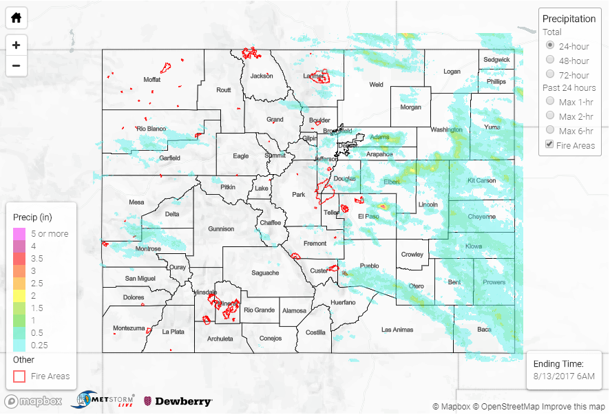
Drier mid and lower levels helped confine the higher precipitation totals to the eastern plains. Over the mountains, a Flash Flood Warning was issued for Rio Blanco County. Radar estimates are as high as 1.6 inches, but no flooding was reported. Over the Front Range, the heavier precipitation fell over the adjacent plains along the Palmer Divide. A CoCoRaHS station recorded 3.17 inches of rain over El Paso County with radar estimates as high as 4 inches (1 in 50 year event). An Areal Flood Advisory was issued but no reports of flooding as of this morning. Over the Denver Metro area rain rates of 0.5 inches in 10 minutes occurred, but storms were short-lived. Further east over the plains, 2 inch hail and gusty winds accompanied the severe thunderstorms. There were a couple of tornado reports in Washington County near Anton, Colorado. 1-hour rain rates were as high as 1.5 inches with storm total rainfall estimated at 2 inches. As of this morning, there were no flooding reports.
The Arkansas River gage at La Junta continues to run at Action stage and will be closely monitored throughout the day as widespread rainfall is likely over the Southeast Plains. Please see the Flood Threat Bulletin for more details.
To see how much rain fell in your area, scroll down and take a peek at the State Precipitation Map below.