Issue Date: Thursday, August 10, 2017
Issue Time: 11AM MDT
Summary:
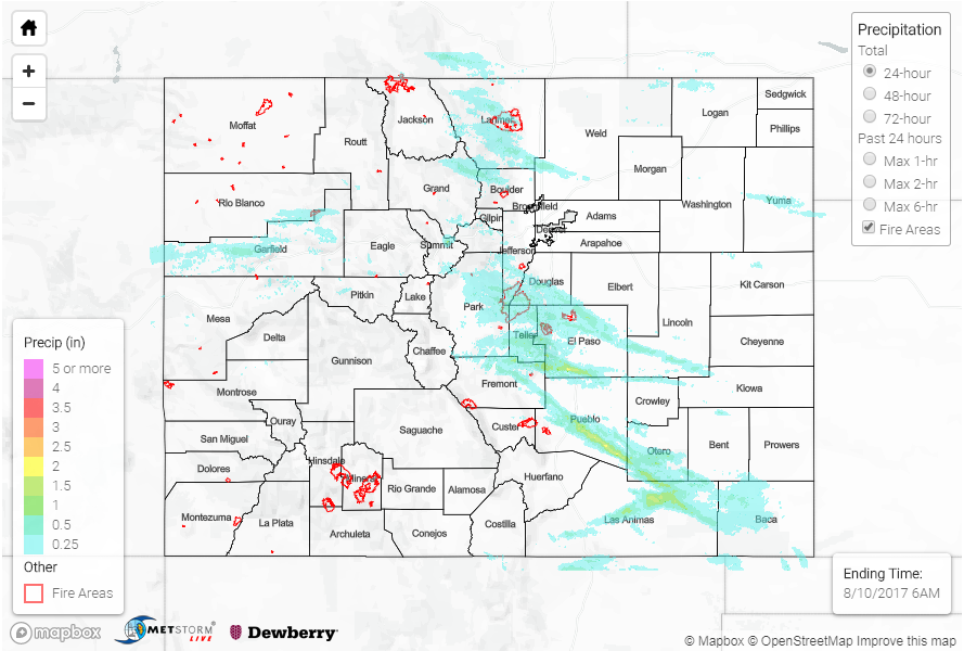
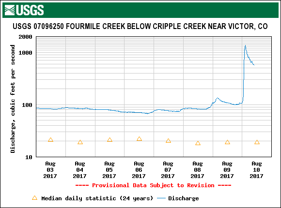
Though rainfall coverage was lower on Wednesday compared to previous days, this did not stop Mother Nature from delivering more heavy rainfall across parts of our state. Several rounds of shower and storm activity developed along the Front Range and then trekked south and eastward during the afternoon and evening hours. The most impactful storm of the day was probably over Teller County, where over 2 inches of rainfall likely fell in a 60-90 minute period. County Road 11 was flooded with 6 inches of water northwest of Cripple Creek. Some impressive streamflow spikes were measured from this storm. Fourmile Creek went from 100 c.f.s. to over 1,000 c.f.s. in less than 90 minutes (see below). Turkey Creek also experienced a brief spike, though flooding was not an issue.
Additional heavy rainfall occurred farther south and east as storms moved off the Palmer Ridge in the later afternoon and evening hours. At least two different storms moved across the cluster of USGS rain gages in Las Animas County, which measured two different pulses of about 1 inch per hour of rainfall. A few of the stronger cells became severe, prompting severe thunderstorm warnings for large hail and gusty winds.
Meanwhile, out west, storm coverage was isolated to scattered in nature. Rainfall amounts up to 0.5 inches were recorded, along with a few reports of gusty winds.
For rainfall estimates in your area, check out our State Precipitation Map below.