Issue Date: Friday, August 4, 2017
Issue Time: 10:00AM MDT
— Flooding is NOT expected today
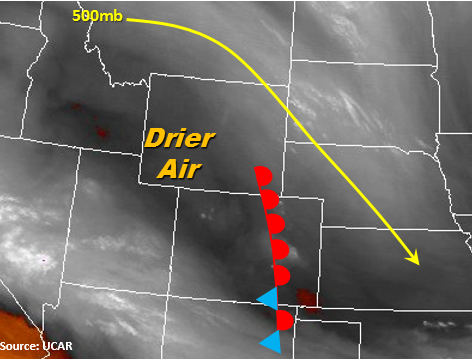
Northwest and westerly flow will remain over the state again today with the upper-level ridge centered north and just west of Colorado. This will usher in drier air at the mid-levels that will help mix out some of the moisture at the lower levels over the NW portion of the state. Over the eastern portion of the state, the early morning fog and low-level clouds should quickly wear off after some morning heating. Low-level southerly flow will pull some moisture into the eastern plains today. Precipitable Water at both Denver and Grand Junction this morning are about 0.75 inches, with the eastern plains increasing some this afternoon. Over the northeastern portion of the state, shear will be greatest with a bit of upper-level upper air support. If storms forming off the Cheyenne Ridge and northern Front Range are able to move into this area, they may become severe with large hail and strong winds as the main threats. Rain rates should stay below flood threat criteria.
Storms will begin to fire off the southern higher terrain midday with the diurnal heating pattern. The synoptic scale downsloping flow today will limit the coverage of the storms over the eastern mountains. Where upslope flow will still prevail is over the southern Front Range, Raton Ridge and San Juan Mountains. Over the San Juan Mountains, 3-hour totals up to 1.2 inches are possible as higher moisture air is pulled in from southern Utah and northern Arizona. As storms move S/SE off the mountains into the eastern plains, they will likely dissipate except for a few isolated showers that may survive along the Palmer and Raton Ridge. Rainfall rates, again, will be below flood threat criteria. Storms over the eastern plains will exit the state around 11PM, while the main storms over the mountains will end by 9:30 PM.
Today’s Flood Threat Map
For more information on today’s flood threat, see the map below (hover over threat areas for more details). For Zone-Specific forecasts, scroll below the map.
Zone-Specific Forecasts:
Front Range, Urban Corridor, Palmer Ridge, Northeast Plains, Southeast Mountains, Raton Ridge, Southeast Plains:
Low-level clouds early this morning but will become sunny through the day. Expecting isolated showers and thunderstorms to develop over the mountains around midday and last into the evening hours over the plains. Highest coverage will be along the southern Front Range, Palmer Ridge and Raton Ridge. If storms forming off the Cheyenne Ridge and Northern Front Range are able to make it to the Northeast Plains, they may become severe with the more favorable thunderstorm environment. Max 1-hour rainfall up to 1.5 inches (east) and 1 inch (west). No flood threat has been issued for today.
Primetime: 12PM to 11PM
Northwest Slope, Grand Valley, Southwest Slope, Northern Mountains, Central Mountains, San Juan Mountains, San Luis Valley:
Mostly sunny and warmer today over the NW corner of the state. Scattered thunderstorms expected throughout the afternoon over the San Juan Mountains with 3-hour totals up to 1.2 inches. Max 1-hour rainfall up to 0.7 inches (north) and 0.9 inches (south). There is no flood threat for today.
Primetime: 12PM to 10PM