Issue Date: Wednesday, July 26, 2017
Issue Time: 10:05AM MDT
Summary:
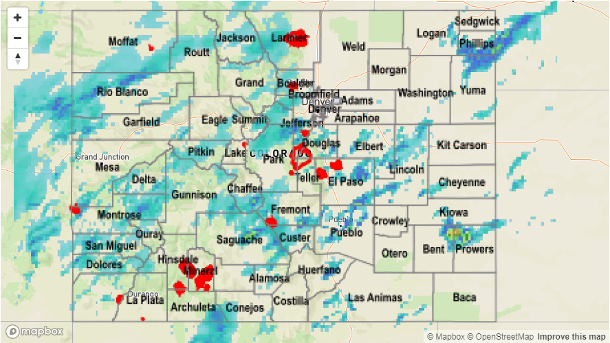
Yesterday morning started with clouds over most of the state and lingering showers over the west, central portion of the state. Cloud cover helped both keep temperatures down as well as limited instability over the northern portion of the state. Higher moisture also began to pour into the eastern portion of the state throughout the day. Daytime heating helped burn off some cloud cover, and around noon, the next set of storms started firing over the higher terrain starting in the south. Over the Western portion of the state, estimated 1-hour rain rates were under an inch. However, ongoing showers and thunderstorms throughout the day made a problematic situation for 3- and 24-hour totals on already saturated soils. Several Areal Flood Advisories were issued. Storm total estimates were as high as 2 inches in the mountains with the highest reported 1-hour rainfall of 1.82 inches in Saguache County at a CoCoRaHS station. In Montrose, 0.5 inches of rain fall in 25 minutes. Another location in Montrose reported 0.85 inches in 30 minutes. Trimble, CO reported 1.1 inches in the 24-hour period. Water was flowing across Highway 141 at mile marker 3 north of Dove Creek in Dolores County. All creeks north of Dove Creek were reported to be running full and spilling into the washes west of Dove Creek that cross Highway 491.
In the Front Range, cloud cover helped limit instability along the Urban Corridor. Storms over the higher terrain had storm totals up to 1.6 inches, but most quickly dissipated or weakened as they moved into the plains except over the Palmer Divide. An isolated storm managed to hold together out over the Southeastern Plains. The winds were strong enough to blow over several trees near Lamar at 4:30PM. Storm totals were as high as 3 inches with 1-hour rain rates up to 1.5 inches. Lastly, heavy rain producing thunderstorms were able to initiate over the NE corner of the state in the higher instability during the late afternoon and evening. Storm totals were 1.5 inches. There was no flooding reported with these storms.
To see how much precipitation fell in your neighborhood the last 24-hours, check out the Precipitation Map below: