Issue Date: Tuesday, July 25, 2017
Issue Time: 10:50AM MDT
Summary:
A surge of monsoon flow yesterday brought extremely high amounts of moisture into the state. Precipitable Water was at near record levels over the western portion of the state. This allowed numerous storms began firing over the higher terrain with the upslope flow around 11am. There was nearly continuous rain in the western portion of the state yesterday that continued through this morning. Isolated light showers are ongoing over the Southwest Slope and are moving northward/northwestward. These storms should begin to dissipate just as the next round begins to fire over the higher terrain. The continuous rainfall on saturated soils again today will exacerbate the danger of debris slides, mud flows and small stream flooding.
Yesterday, the 1-hour maximum rain rates were estimated by radar to be just over 0.5 inches over the western portion of the state. The more meaningful 24-hour accumulations, on top of already saturated soils, were estimated to be as high as 1.6 inches. Heavy rainfall was reported in Durango with 0.75 inches falling in a short period of time. Over La Plata County, heavy rain of 0.94 inches was reported. The CoCoRaHS stations in La Plata County had widespread reports of 0.75-0.85 inches. A SNOTEL site in the San Juan Mountains reported 1.30 inches falling in the 24-hour period. Gusty winds accompanied these storms with a gust of 51 mph recorded at the Grand Junction Airport. Over the Front Range, an isolated cell in Teller County dropped an estimated 1.5 inches of rain. Large rivers continue to run under Action Stage in the higher terrain and Western Slope, but small streams are likely running high and should be monitored closely throughout the day with this next round of precipitation.
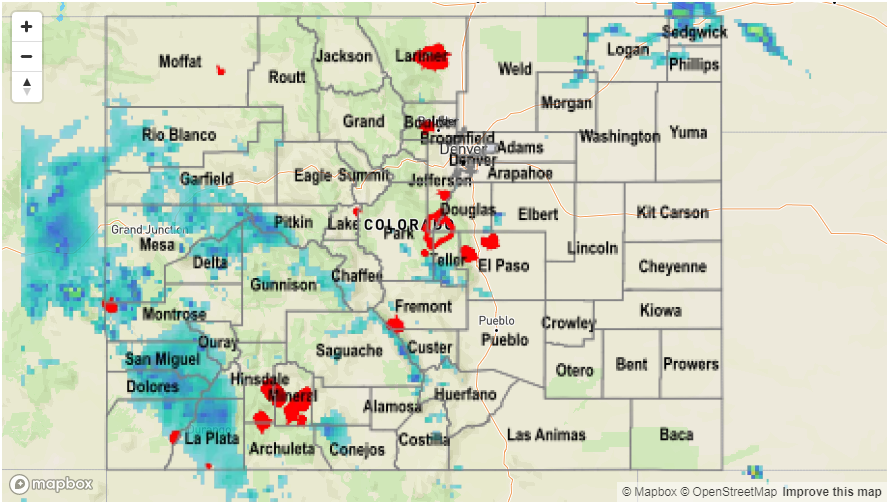
As of this morning, there were no flood reports for Monday. For rainfall estimates in your area, take a look at the Precipitation Map below.