Issue Date: Monday, July 24, 2017
Issue Time: 11AM MDT
Summary:
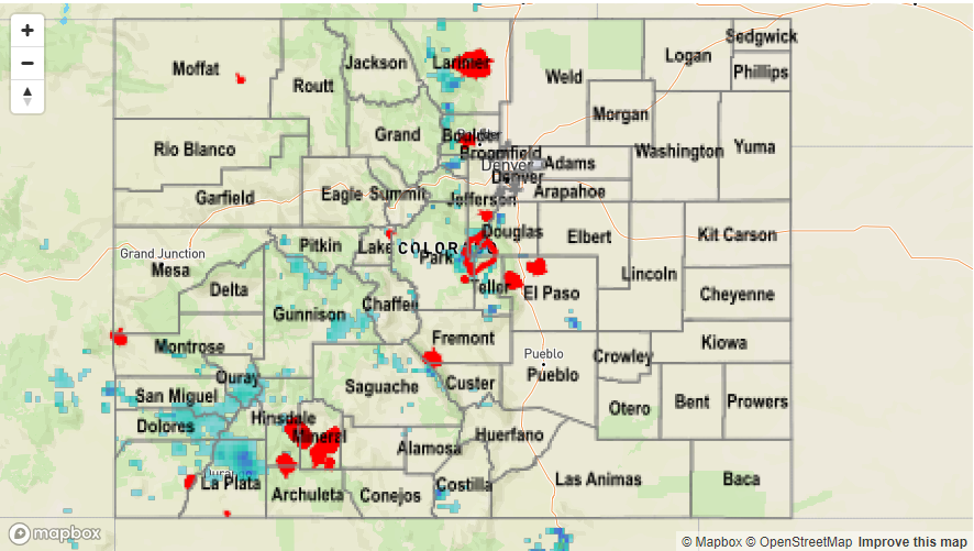
Though moisture decreased on Sunday, compared to the previous days, it is always good to keep in mind that our impressive mountains are capable of generating their own circulation. This allows for the production of storms that may seem surprising to a non-local. During clear summer mornings, quick heating allows the higher elevations to heat up higher than the nearby airmass (at the same altitude). This drives an upslope circulation that can create many intricacies that would be impossible without the mountains. The Palmer Ridge is a favored area for such processes. On Sunday, several nearly stationary cells developed on the northern side of the Palmer Ridge. Despite only lasting for an hour or two, the cells were able to deliver impressive rainfall amounts. One of the cells, over southern Douglas County, happened to fall directly on a rain gage maintained by the Urban Drainage and Flood Control District, which measured 1.02 inches of rain in 30 minutes. Another cell formed almost directly over the USGS gage on the South Platte River (near Cheesman Lake), where over 1 inch fell in less than 1 hour. What are the odds that each storm fell directly over a well maintained gage? Who knows, but we are grateful!
Farther west, stubborn moisture with monsoon origins, refused to leave Colorado. Although storm activity was less widespread than the past 48 hours, the strongest cells were still able to deliver heavy rainfall. For example, a CoCoRaHS observer in La Plata County reported 1 inch of rainfall in less than 1 hour.
Fortunately, flooding was not reported on Sunday. For rainfall estimates in your area, check out our Precipitation Map below.