Issue Date: Monday, July 17, 2017
Issue Time: 2:10PM MDT
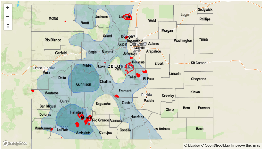
Valid Dates: 7/18 – 8/1

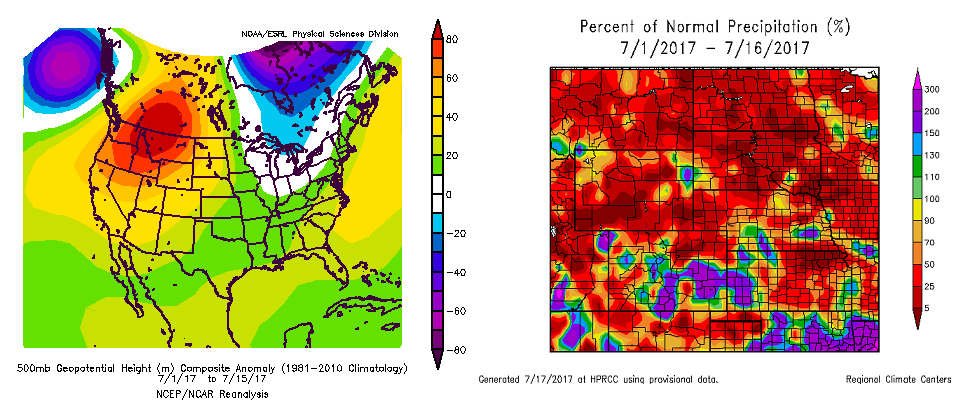
Thus far, July has seen a rather persistent weather pattern marked by a wobbling upper-level ridge anomaly centered north of Colorado. The left map below shows the composite month-to-date 500-mb height anomaly and it is seen that the bullseye of the anomaly is located on the border of Alberta and Montana. The right map below shows month-to-date precipitation anomaly, as a percentage of normal. Generally speaking, wetter than normal conditions have been favored southeast of Colorado with more of both sides of the coin seen for our state. However, a notable exception to this is in southeast Colorado where it has been very wet (up to 250% of normal). One factor that helps explain this is the above normal moisture that has been available for thunderstorm formation, especially in the past 5-7 days.
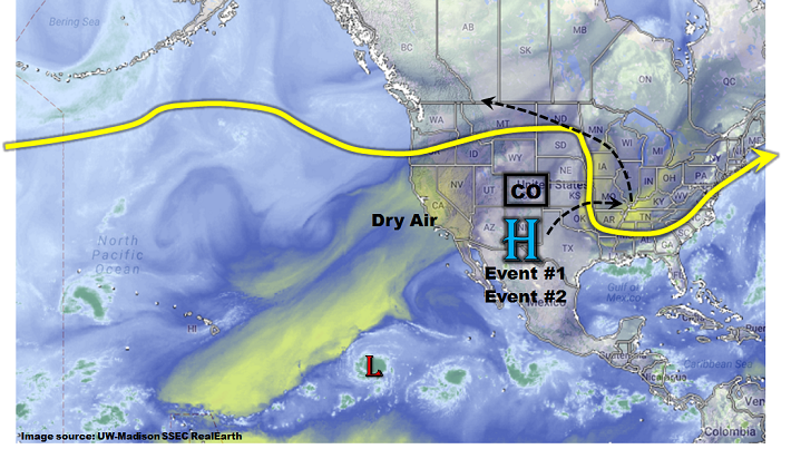
As shown in the current water vapor image, below, things have changed compared to the maps above. The upper-level ridge has flattened a bit and is now centered south of Colorado. Dry air is found far to the west across California and offshore. Meanwhile, moist air, characterized by Precipitable Water values exceeding 1 inch, continues to hold its fort across eastern, southern and southwestern part of Colorado. Over the next 15-day period covered by this Flood Threat Outlook, the key to our weather pattern will once again come down to determining how the upper-level ridge will be positioned. Current guidance suggests the ridge will first move east of the next 3-5 days, followed by a gradual retraction back to the northwest, to be in a position reminiscent of that observed during the first half of July. Importantly, the temporary shift of the ridge to the east will allow for an effective return of both moisture and upper-level dynamics into Colorado.
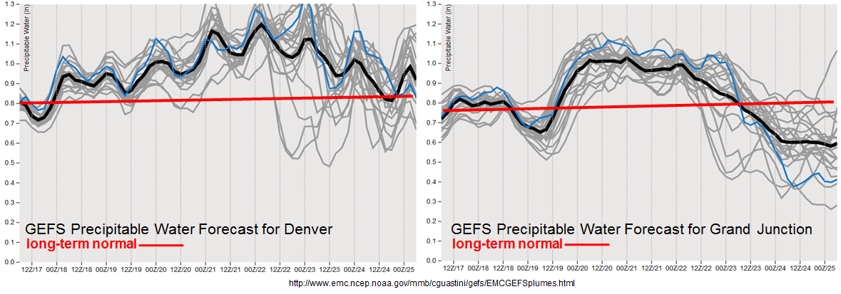
We have identified two organized precipitation events, which together span the first 6 days of this Outlook. The first event will be the result of elevated moisture levels that will produce isolated heavy rainfall mainly over the higher elevations. The second event is a more organized stretch of heavy rainfall potential as a monsoon moisture surge moves north/northeast into Colorado, along with a cool front expected to cross the eastern half of the state. As shown in the forecasted PW plumes for Denver and Grand Junction, both locations will experience generally above or even significantly above moisture content through early next week, which is conducive to heavy rainfall in Colorado. Below each event is described in more detail.
Event #1: Tuesday (7/18) and Wednesday (7/19)
Elevated Flood Threat for isolated higher-elevation heavy rainfall
Above average moisture will continue to maintain a presence over most of Colorado for this event with Precipitable Water values in the 0.75 to 1 inch range statewide. With clear skies in the morning, expect early shower and thunderstorm activity to form across the entire high country, with the highest intensity and coverage over southern areas. Brief heavy rainfall, up to 0.5 inches in 30 minutes will be common, and some locations will experience several rounds of such storms from the later morning through the early evening hours. By later in the afternoon, the merging of storm outflow boundaries will maintain the potential for heavier rainfall, up to 1.2 inches in 1 hour. This will be capable of causing isolated mud flows, debris slides and flash flooding especially over steeper terrain where less rain is needed to cause problems.

Event #2: Thursday (7/20) through Monday (7/24)
Prolonged Elevated/High Flood Threat statewide with monsoon surge (west) and cool front (east) acting as forcing
As hinted by the forecasted PW plumes (see above), higher moisture is expected to arrive into Colorado from the southwest by Thursday, 7/20. PW values are expected to exceed 1.0 inch across most of the state with localized readings up to 1.2 inches (west) and 1.5 inches (east). On Thursday and Friday, scattered to numerous thunderstorm activity is expected for the western slope and Continental Divide. These storms will be capable of producing 0.8 inches of rain in 30 minutes. However, up to 2.0 inches will be possible over a 24 hour period. Mud flows and debris slides will become a bigger impact by Friday, especially over regions that experience consecutive days of heavy rainfall.
By Saturday and Sunday, attention turns east of the Divide as an expected cool front will provide a focal point for storm activity. With relatively weak wind shear expected, relatively brief heavy rainfall is expected. However, with plenty of moisture available, up to 1.8 inches in 30 minutes and 2.7 inches in 1 hour will be possible. Isolated flash flooding appears likely, especially over the sensitive newer burn scars. By later in the event, antecedent wet soils will also contribute to an increased runoff risk. It is possible that event will be upgraded to a High threat by the next Outlook. The day by day features will be described in much more detail in the Flood Threat Bulletins, so stay tuned.