Issue Date: Monday, July 17, 2017
Issue Time: 9:55 AM MDT
Summary
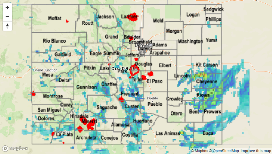
Storms began to fire over the higher terrain again yesterday afternoon. A weak surface low formed over the SE Colorado, which helped pull moisture into the southern portion of the state and helped organize low-level convergence. Although the coverage of storms was less impressive than Saturday, there was still local flooding with storms that were able to fire up. A flash flood warning and flash flood advisory were issued for SW Chaffee County along the Sawatch Range. Radar indicated 1.6 inches of rain over saturated soils. There was also flooding reported along Hayden Creek on the west side of the Hayden Pass burn scar. The last flash flood warning was issued for the Junkins burn scar, although no flooding was reported as of Monday morning. Heavy rainfall of 0.97 inches was reported near Beulah, CO. Totals in the mountains ranged from 1 to 2.2 inches with 1-hr rates just over 1 inch. The largest observed value was at a SNOTEL station near Monarch, which recorded 1 inch of rainfall.
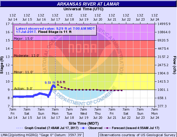
Storms also fired up over the Eastern Plains along the KS border. There were several flood advisories with 1-hr totals of 2.5 inches estimated by radar and 3-hr totals of 3 inches estimated by radar. Local CoCoRaHS showed up to 1 inch of rain over bucketed areas. These storms had heavy rain as well as 0.75 inch hail and gusty winds. Lamar airport recorded gusts of 38 mph. The USGS gage measuring the Arkansas River at Lamar is running at the Action stage from yesterday’s rainfall. CoCoRaHS stations recorded just under 1 inch of rainfall, but radar rainfall estimates over rural Prowers County show 2 inches of rain with other thunderstorms contributing in the Southeast Plains. The Arkansas River level is expected to drop under action level as this area of the state will remain dry today.
For rainfall estimates for the last 24-hours, please see the State Precipitation Map below.