Issue Date: Friday, July 14, 2017
Issue Time: 11AM MDT
Summary:
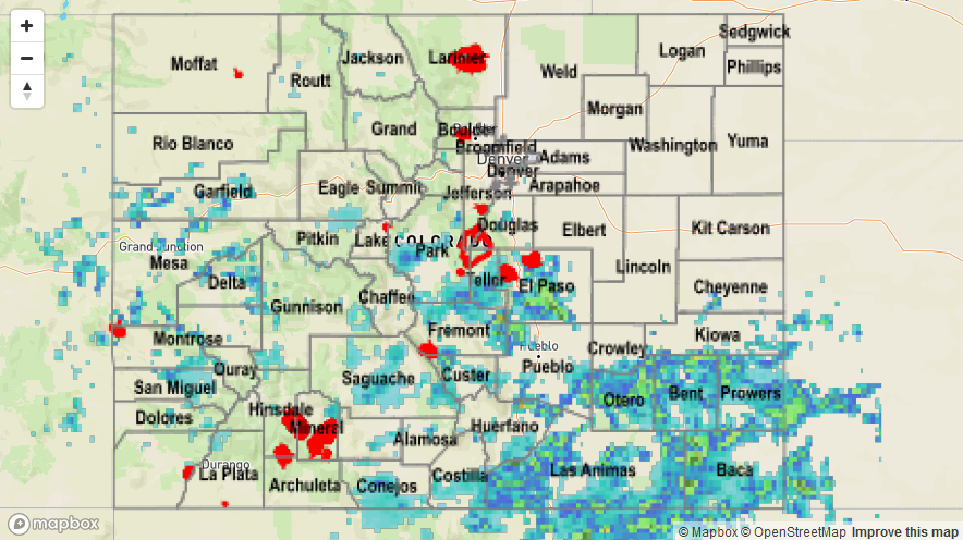
With Precipitable water values continue to hold close to or above 1 inch statewide, heavy rainfall was observed in abundance again on Thursday. The southeast quadrant of the state witnessed the brunt of the activity, though the western slope was also included. The vast majority of storms were rather benign with only very short-term heavy rainfall lasting 15-30 minutes. However, a few stronger cells were noted especially as the afternoon wore on. The highest observed 24-hour total came from Otera County (CoCoRaHS) at 2.12 inches. However, our radar-estimated product shows isolated amounts near 2 inches per hour in Otero and Cheyenne counties with 24-totals exceeding 3 inches in isolated parts of the Arkansas River valley. Wide areas were placed under Areal Flood Advisories during the early evening.
Farther west, isolated to scattered storms produced up to 1 inch per hour of rainfall, requiring several Areal Flood Advisories during the late afternoon.
As of this morning, the only official flood report on Thursday came from Fremont County, which the sheriff’s office posted footage of urban flooding on their social media feed (@Fremont_Sheriff on Twitter). For rainfall estimates in your area, check out the State Precipitation Map below.