Issue Date: Thursday, July 13, 2017
Issue Time: 9:50 AM MDT
Summary
Clouds from the rain complex yesterday morning didn’t burn off as was forecasted. This limited the amount of instability the atmosphere was able to produce in the afternoon in northeastern CO. The clouds were able to give central and northeastern portion of the state a break from the higher temperatures. Downsloping winds north of Denver also helped suppress of storm development. Over the higher terrain, another set of high rainfall yielding thunderstorms were triggered midday. The highest recorded rainfall in the mountain was 1.10 inches by a SNOTEL station in the Loveland Basin.
Monsoon moisture returned to the western slope and the southeastern portion of the state. Near record Precipitable Water in eastern Colorado, a mesoscale surface low over the SE and a boundary help set the focal point for storms over the eastern plains yesterday afternoon. The Moderate threat was upgraded to a High threat at 5:30 PM MDT.
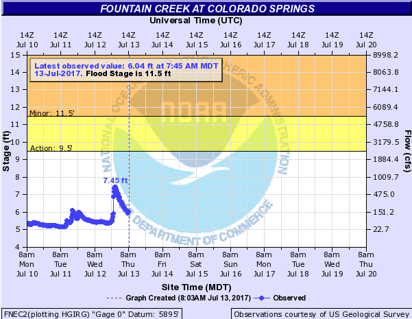
Yesterday morning, National Weather Service Pueblo issued a Flash Flood Watch at until 10 PM MDT for flash floods overs several burn scars in the area and Colorado Springs. 1.17 inches was recorded near the Wet Mountains, which is close to a couple recent burn scars. There was even a brief tornado warning for Teller County, but no tornado was reported. Over the Air Force Academy, an ASOS recorded an 80 mph wind gust and 0.67 inches in one hour. Heavy rain was reported with the largest total being 1.54 inches. Two hour rain totals were as high as 2 inches. Estimated storm totals over this area ranged from 1.5 to over 2.2 inches. Below you can see the spikes in runoff at the USGS gage Fountain Creek in Colorado Springs from the rainfall the last couple of afternoons.
Elsewhere, there was a Flash Flood Warning for I-70 between Rifle and Parachute for a storm that produced 1.5 inches of rain. Last year in this area, many mud slides over the higher terrains were reported whenever there was heavy rainfall. There were no reports of flooding or mudslides in this area yesterday. The most impressive total from yesterday was along the Palmer Divide where a severe thunderstorm near Limon dropped 1.26 inches of rain in 30-min. A wind gust of 62mph was also recorded at the Limon Airport. The last flash flood warning of the day was for the storms that formed on the boundary in the eastern plains in the afternoon and evening hours. Rainfall totals over the far rural eastern plains were estimated in the range of 1.5 inches to over 3 inches with the highest recorded CoCoRaHS values being 2.5 inches in Yuma County and 2.83 inches in Lincoln County. There was no flooding reported with these storms.
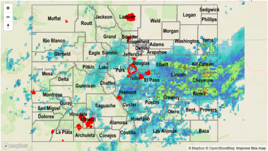
For rainfall estimates in your neighborhood, check out the State Precipitation Map below.