Issue Date: Wednesday, July 12, 2017
Issue Time: 10:50AM MDT
Summary:
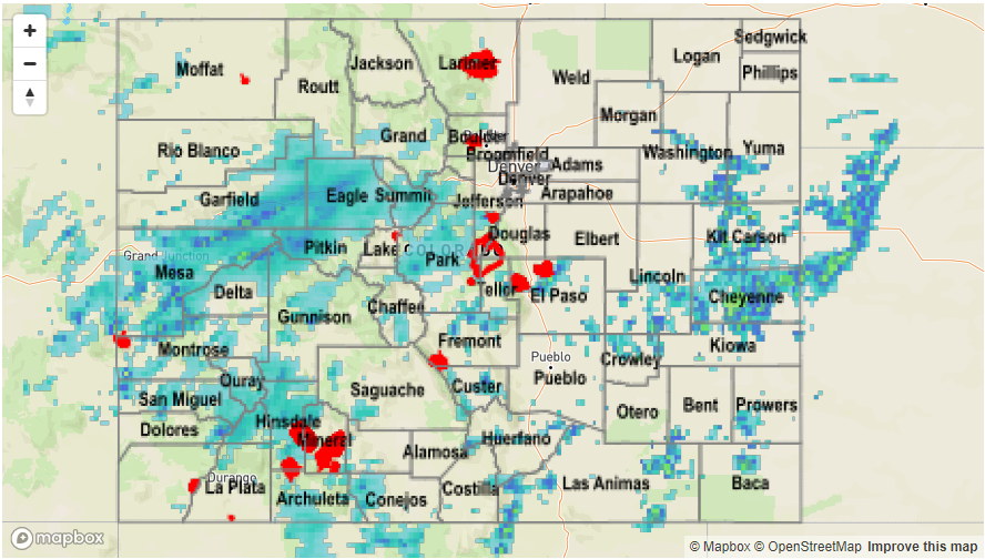
Southwesterly flow increased available moisture for storms yesterday. Although moisture did not increase as much as predicted, there was still enough moisture for numerous storms over the higher terrain. The most moisture was located in the western and central portion of the state, where there has been a great need for measureable precipitation. Gusty winds accompanied many storms with the highest recorded gust being 47 mph outside Craig, CO. Over the higher terrain, radar estimated totals were as high as 1.8 inches. The largest observed rainfall was 1.7 inches by a SNOTEL station at the foot of Blanca Peak in Costilla County. 1.4 inches of rain was recorded just north of Mesa, CO. Rainfall continued over the higher terrain and eastern plains into the night, which helped ease the fire danger.
Slow moving storms created locally heavy rainfall. In Pitkin County, there was a debris flow reported at 7PM MDT. Heavy rain caused a rock slide that blocked the eastbound lanes on CO 82 at mile marker 35.9. There was also a flood advisory for stream flooding in SW Las Animas County where a storm quickly produced over 2 inches of rain (radar estimated). Another flood advisory was issued for a thunderstorm that passed through Colorado Springs mid-afternoon. The storm dropped 1.07 inches of rain in 1 hour at a USGS gage and caused minor flooding at Fillmore and Nevada. The last flood advisory was for the western side of the Junkins burn scar which saw 0.6 inches, but there were no reports of stream flooding. In the eastern plains, a thunderstorm warning was issued for eastern Cheyenne County at 8:15PM MDT for 60 mph gust and quarter size hail. Despite storm totals of 2.2 inches, there was no flooding reported during this time.
To see how much rain fell in your neighborhood, scroll down to see the State Precipitation Map.