Issue Date: Monday, July 10, 2017
Issue Time: 3PM MDT
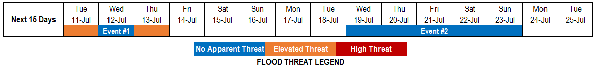
Valid Dates: 7/11-7/25
Once again, the upper-level ridge that is typically a staple over western North America during the summer months, continues to maintain a firm grasp on Colorado’s weather. Although it is common to see the ridge centered somewhere in close proximity to Colorado, the past 7-14 days have seen remarkably little variation in the ridge position and intensity. Furthermore, there has been a near absence of any upper-level disturbances. Interestingly, it appears this pattern will persist for nearly the entire period covered by this 15-day Flood Threat Outlook. Although the upper-level ridge is expected to wobble around a bit (see water vapor image, below), it will remain centered very close to Colorado. Such a pattern is simply not conducive for any kind of organized rainfall in our state. That is not to say there will not be heavy rainfall, but such activity is expected to remain of a very isolated nature.
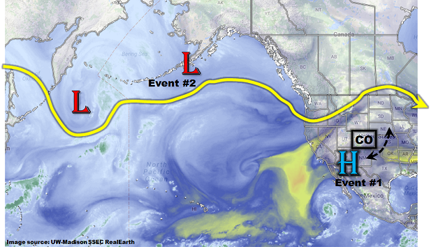
We have identified two precipitation events for this Outlook. The first event will be associated with a surge of monsoonal moisture traversing the state over the next 72 hours. An elevated flood threat is anticipated for isolated flash flooding. Notably, the western slope will get much needed rainfall. After a break in action, another event is identified later in the Outlook. Current guidance suggests influences from both the main jet stream as well as possible monsoonal moisture (and inverted trough from the south). Unfortunately, it is too soon to determine if a flood threat will accompany the second event.
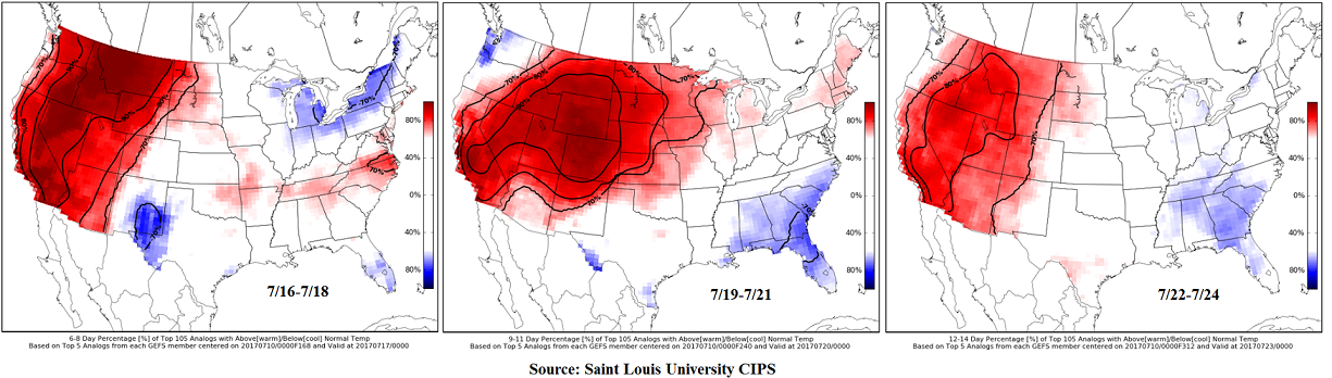
What is much more certain is the incredibly persistent above average temperatures expected for at least a portion of the state over nearly the entire Outlook (see image below). This follows on the heels of a very warm June, almost setting in stone above average July temperatures, at least on a statewide level.
Below we describe each of the two identified precipitation events in more detail.
Event #1: Tuesday (7/11) through Thursday (7/13)
Elevated Flood Threat as monsoonal surge treks across the state
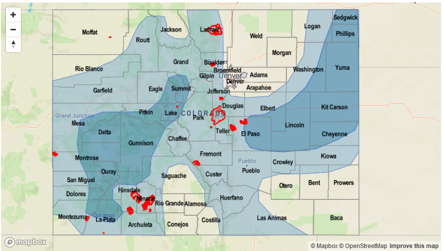
A surge of monsoon moisture will move across Colorado starting on Tuesday, supporting heavier rainfall both west and east of the Continental Divide. First on Tuesday, scattered to numerous showers and storms are expected over the San Juans, Central Mountains and Northern Mountains. With little shear and negligible upper-level forcing, only relatively brief heavy rainfall is expected. Max 1-hour rain rates could approach 1 inch per hour in favored parts of the western Central Mountains and San Juans. Isolated flash flooding, mud flows and debris slides will be possible, especially given the parched soil that will promote initial rapid runoff. Meanwhile, out east, a round of showers and storms is expected to develop mainly over the Palmer Ridge and track eastward. With plenty of moisture in place, quick bursts of heavy rainfall, to the tune of 1.25 – 1.5 inches per hour will accompany the strongest cells. Gusty winds will be possible in cells that are light on moisture content as rain-cooled downdrafts descend to the surface. Scattered shower and storm activity is expected for Wednesday though with lower rainfall rates. By Thursday, a cool front will graze eastern Colorado and support higher rainfall rates, up to 1.5 inches per hour. Isolated flash flooding will be possible.

Event #2: Wednesday (7/19) through Sunday (7/23)
No Apparent Flood Threat as a combination of disturbances approach Colorado
A persistent ridge will reform after Event #1, causing above average temperatures statewide (especially out west). The first signs of a possible pattern shift may be on the horizon as a disturbance currently situated across the central Pacific begins to move eastward. At the same time, the upper-level ridge is expected to move east allowing for some easterly transport of relatively moist area into Colorado. A prolonged period of unsettled weather may be on tap for both eastern and western Colorado. However, currently, there is only marginal confidence for widespread rainfall, and even less confidence of heavy rainfall. The precipitation map shows the possibility of rainfall east and west of the Divide but amounts are expected to remain below 1.0 inch. Thus, flooding is not expected at this time. Stay tuned to Thursday’s Flood Threat Outlook for an update on this event.