Issue Date: Sunday, July 9, 2017
Issue Time: 10:20AM MDT
Summary:
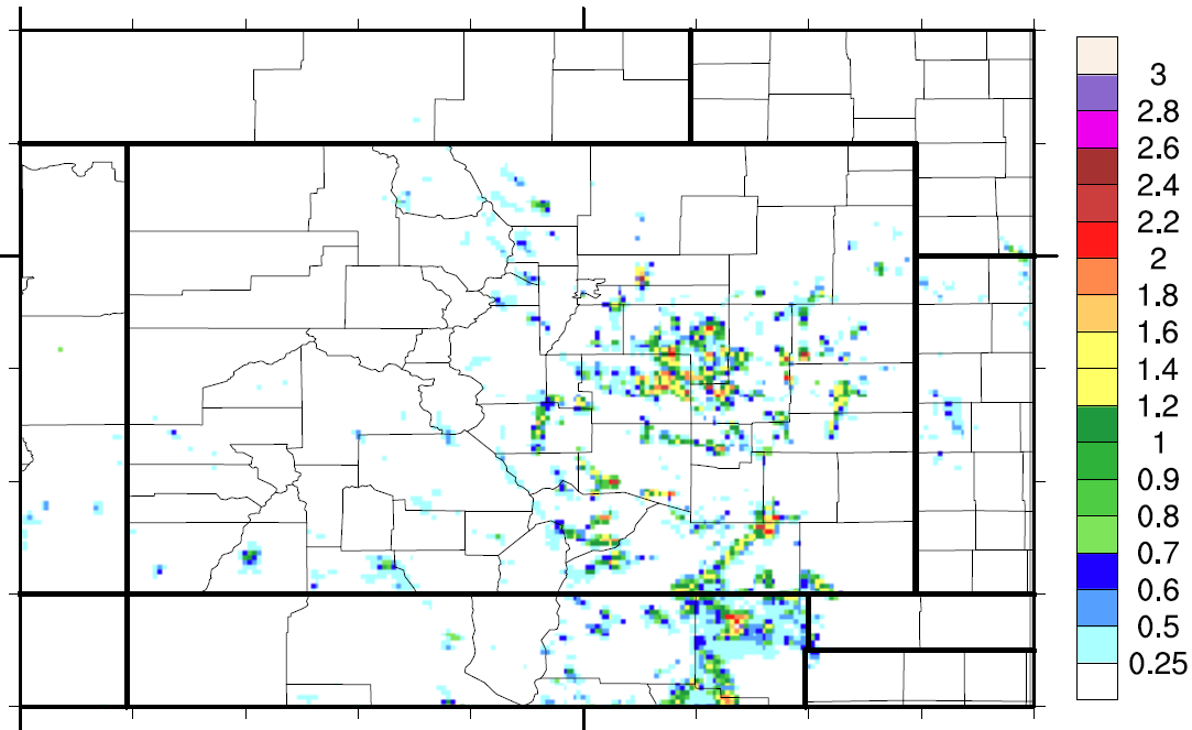
A weak disturbance rounded the periphery of the Great Basin ridge, causing another day of scattered afternoon and evening showers and storms across mainly eastern Colorado. With weak shear, pulse type storms were the common type, especially during the early afternoon hours – with a quick 0.5 inches of rain falling in 30 minutes or less. Later in the afternoon, as outflow boundaries merged, a few stronger storms emerged with up to 1.5 inches per hour falling in parts of the Front Range, Urban Corridor, Palmer Ridge and Southeast Plains. Another Flood Advisory was issued for the Junkins fire burn area during the late afternoon.
West of the Continental Divide, heat was once again the theme with Grand Junction notching another rain-free day (#33 to be exact) and a high temperature reaching 100F. Farther south along the NM border, high-based isolated storms were able to deliver precipitation all the way to the ground with up to 0.6 inches falling in La Plata County.
Flooding was not reported on Saturday. For rainfall estimates in your area, check out the State Precipitation Map below.