Issue Date: Thursday, July 6th, 2017
Issue Time: 3PM MDT
Valid Dates: 7/7-7/21
 Just like the last Flood Threat Outlook, we do not have to look far away from home to foresee what is in store for Colorado’s weather during the next 15-day period. Shown in the water vapor image, below, we see a strong upper-level high pressure ridge currently positioned just west of our state. With strong subsidence underneath and to the east of it, very hot temperatures of 5-15F above normal have been the rule over the past few days. Today’s guidance is in remarkably good agreement that a relatively persistent pattern will continue over at least the next 7-10 days and perhaps even through the entire 15-day period. This pattern will be marked by the above average intensity upper-level ridge over central and western North America and a trough of low pressure off the west coast. Despite the pattern’s persistence, subtle shifts in the ridge’s position will have sizeable implications on Colorado’s precipitation chances.

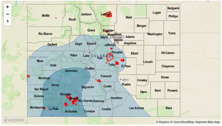
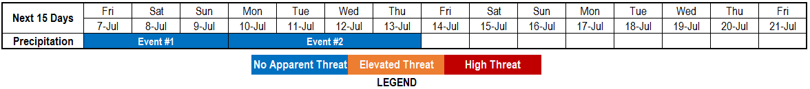
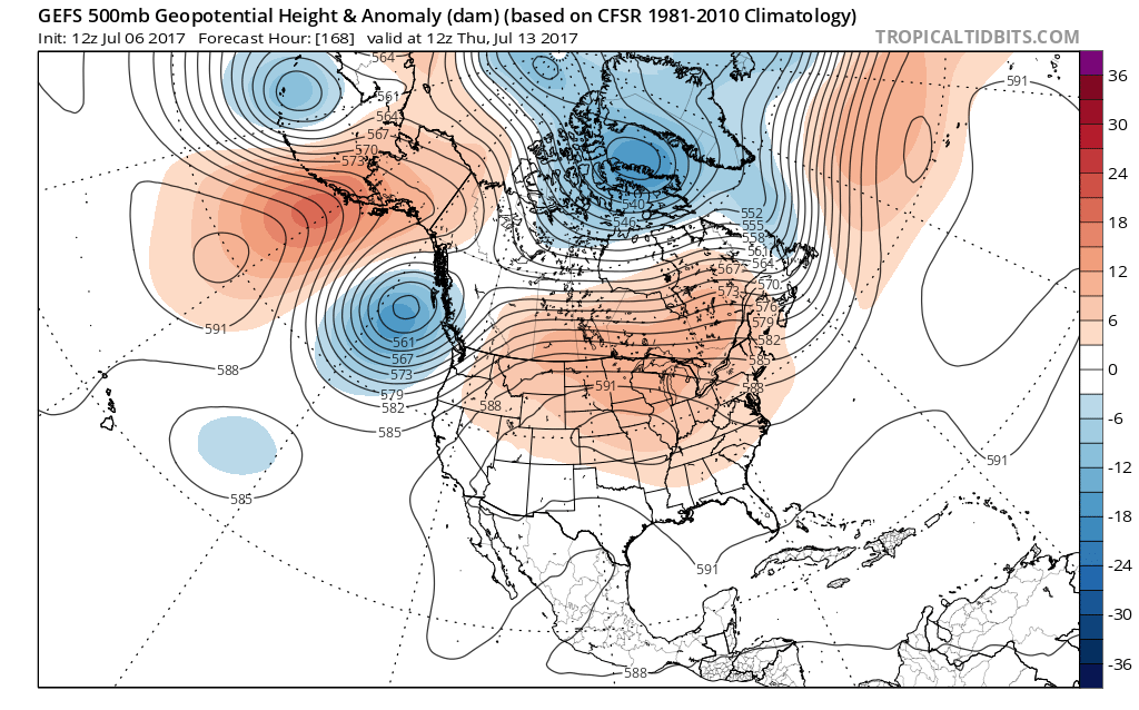
There are two precipitation events that have been identified for this Outlook. The first event will be courtesy of a surface high pressure and attendant cool front that will sweep across mainly eastern Colorado on Friday. This will increase shower and storm chances out east for Friday, with decreasing coverage on Saturday and Sunday. With average to above average Precipitable water expected, short-term heavy rainfall will be possible but flooding is not expected. The second event will be the season’s first organized surge of monsoon moisture from the southwest. This will begin by early next week but peak by next Wednesday or Thursday, as the ridge wobbles far enough east to promote southerly moist flow statewide (see the forecasted 500-mb height anomaly pattern below). Although isolated heavy rainfall will be likely during Event #2, the lack of confidence in the moisture availability (especially regarding near-surface moisture) does not support an elevated flood threat at this time.
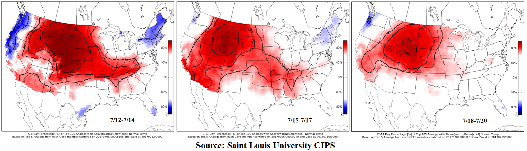
After Event #2 guidance continues to show a persistent high pressure ridge expected over or north of Colorado, supporting above normal temperatures for the tail end of the 15-day period. This can be seen below using the Saint Louis University’s CIPS analog guidance, which shows probabilities of temperature being above or below normal. A noteworthy impact of this would be a continued risk of elevated fire danger, which research has shown is dictated by prolonged periods of above normal temperatures.
Below we describe each of the two identified precipitation events in more detail.
Event #1: Friday (7/7) through Sunday (7/9)
No Apparent Flood Threat as cool front traverses across eastern Colorado
A cool front will move southward across eastern Colorado on Friday, providing an enhanced focus for shower and storm activity. Short-term heavy rainfall will be possible mainly across eastern Colorado, though the higher elevations could also experience isolated heavy rainfall producing storms. Up to 0.6 inches in 30 minutes will be possible except for far eastern areas where up to 1.5 inches per hour will be possible. These intensities are below flash flood levels, and flooding is not expected. As the front losing momentum in southern Colorado, the diurnal upslope flow will allow for better storm coverage across the Southeast Mountains, Raton Ridge and Southeast Plains on Saturday and Sunday. However, with no upper-level support, thunderstorm activity is expected to remain of the pulse variety with only 15-30 minutes of heavy rainfall under any given storm. Up to 0.7 inches of rainfall in 30 minutes will be possible.
West of the Continental Divide, increasing low-level moisture will continue to support isolated to scattered storm activity. Up to 0.6 inches per hour is possible here. With these values being well below flood-intensity thresholds, flooding is currently not expected.

Event #2: Monday (7/10) through Thursday (7/13)
No Apparent Flood Threat at this time as moisture and precipitation chances finally increase for western slope
The first organized surge of monsoon moisture is expected to affect Colorado starting early next week. Precipitable water values will increase to near 1 inch along the Utah border. Daily rounds of afternoon/evening shower and storm activity will increase in coverage on Monday and Tuesday, peaking on Wednesday and Thursday. With only weak wind shear, only short-term heavy rainfall is expected. Max 30-minute rates up to 0.6 inches will be possible. However, with the prolonged duration of the event, the rainfall will gradually add up. Over 1.5 inches of total event rainfall will be possible along the climatologically favored southern slopes of the San Juans and perhaps the Central Mountains. At this time, there is no apparent flood threat. However, it is possible that this event will be upgraded to an elevated flood threat by Monday’s Outlook. Stay tuned.