Issue Date: 7/4/2017
Issue Time: 9:00 AM
NO FLOOD THREAT IS FORECAST.
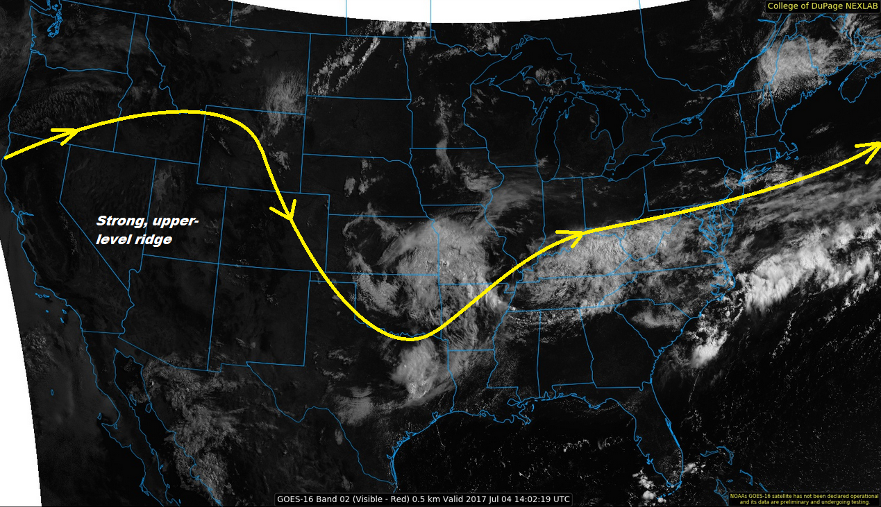
Mother Nature is doing her best to give Colorado nice weather for Independence Day, and generally speaking, she is coming through. A strong, upper-level ridge is building in from the west today, and will result in increasing subsidence and decreasing showers/storms as compared to the past few days. There is still enough shallow moisture in place for isolated showers/thunderstorms this afternoon and evening, but for most regions they will produce more gusty winds and lightning than rain.
The exception to this will be over the far eastern plains, where a bit more surface moisture and instability exists, giving the atmosphere an opportunity to produce brief periods of moderate rainfall, hail up to 1 inch in diameter, and strong winds up to 60 mph. Rain rates will still not meet flash flood thresholds, so no flood threat is warranted. For more information regarding timing and rain rates, please see the zone-specific forecast discussions below.
Today’s Flood Threat Map
For more information on today’s flood threat, see the map below (hover over threat areas for more details). For Zone-Specific forecasts, jump below the map.

Zone-Specific Forecasts
Palmer Ridge, Northeast Plains, and Southeast Plains:
Mostly sunny skies and hot temperatures will be the main weather story today, with isolated thunderstorms expected to break up the otherwise quiet weather during the afternoon and evening hours. Maximum rain rates are as follows:
Western half of Palmer Ridge: 0.2-0.4 inches/hour
Eastern half of Palmer Ridge: 0.4-0.8 inches/hour
Northeast Plains and Southeast Plains: 1.0-1.5 inches/hour
Timing: Noon – 10 PM
Northern Mountains, Northwest Slope, Front Range, Urban Corridor, Southeast Mountains, Central Mountains, Grand Valley, Southwest Slope, Raton Ridge, San Juan Mountains, and San Luis Valley:
Mostly sunny skies and warm/hot temperatures are expected, only to be broken up by isolated showers/weak thunderstorms. The best coverage of storms, relatively speaking, will occur over the Front Range, Southeast Mountains, and the Urban Corridor, with lesser activity expected elsewhere. With dry sub-cloud air in place, evaporation of falling precipitation will be efficient, showers/storms will result in mainly gusty winds and light rainfall. Dangerous cloud-to-ground lightning is expected from thunderstorms, so please whenever you hear thunder roar, go indoors. Maximum rain rates are as follows:
Northern Mountains, Central Mountains, Front Range, Southeast Mountains, Urban Corridor, San Luis Valley, and San Juan Mountains: 0.4-0.8 inches/hour
Raton Ridge: 0.5-0.9 inches/hour
Southwest Slope, Grand Valley, and Northwest Slope: 0.1-0.3 inches/hour
Timing: Noon – 10 PM