Issue Date: Monday, June 19th, 2017
Issue Time: 2:30PM MDT
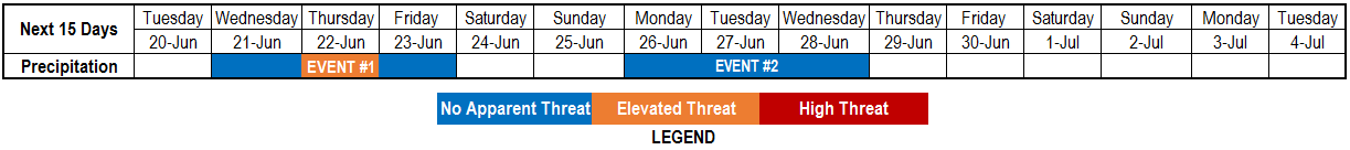
Valid Dates: 6/20 – 7/4
A hot and relatively dry air mass has developed over the Great Basin, extending into western Colorado as of this afternoon (6/19). This is courtesy of a strong high-pressure ridge, the strongest of the young summer that will continue to strengthen over the next 24-48 hours. The result will be very hot temperatures, to the tune of 10-15 F above normal, and dry conditions through Tuesday. Thereafter, a low pressure system (currently in the Gulf of Alaska, as seen in the water vapor image, below) will temporarily displace the high pressure ridge and deliver a significant Pacific-origin cool front across eastern Colorado. This will be responsible for the first precipitation event noted in today’s threat timeline.
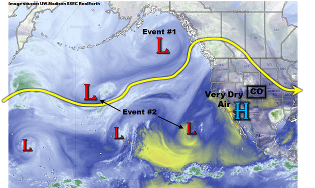
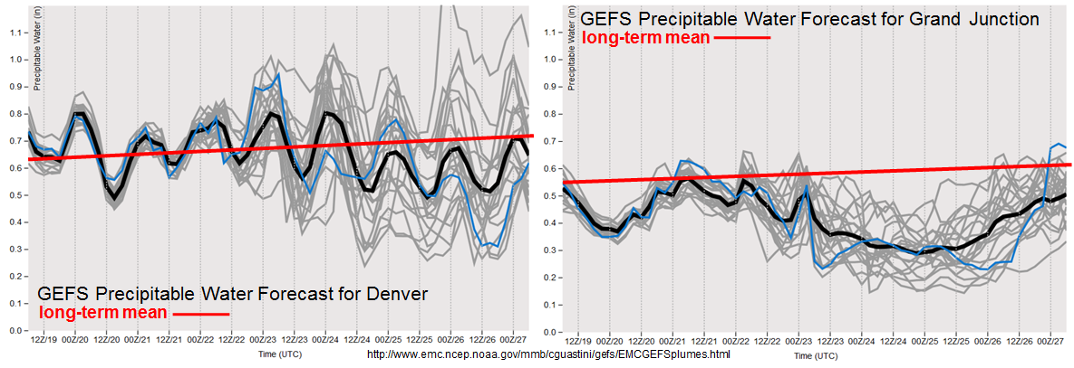
As shown in the forecasted Precipitable Water (PW) plumes, below, there will continue to be a significant disparity between conditions east of the Continental Divide and those to the west over the next 7 days. Event #1 will be generally limited to eastern areas. However, there are now indications that the season’s first push of monsoon moisture may begin to impact the southwest United States by early next week. More specifically, this appears to be due to a combination of two disturbances (one in the mid-latitudes, the other in the subtropics) that will merge before entering North America. At this time, the amount of moisture available with this event is highly uncertain, as can be seen from the very large spreads in the PW forecast by June 27th, especially east of the Continental Divide. However, some precipitation appears likely over southwest Colorado. Thereafter, a period of drying looks to keep this quiet with seasonable temperatures.
Below we describe each of the two identified precipitation events in more detail.
Event #1: Wednesday (6/21) through Friday (6/23)
A multi-day period of enhanced precipitation, with one day of Elevated Flood Threat
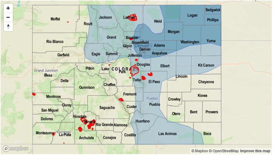
A Pacific-origin cool front will come in from the northwest in combination with a southward movement of the main jet stream. Precipitation chances will first increase on Wednesday, with some scattered shower and storm activity likely towards the Kansas border. The highest threat, at this time, appears to be Thursday as Precipitable Water values exceeding 1 inch get drawn into eastern Colorado. Scattered to numerous showers and thunderstorms are expected on Thursday, with the highest coverage being in eastern Colorado. A severe weather threat, including large hail and tornadoes, is also anticipated. In terms of rainfall, expect hourly rainfall up to 1.25 inches per hour in the Front Range to 1.5 inches per hour farther east. An elevated flood threat will exist mainly for isolated flash flooding.
By Friday, most of Colorado will be under a more stable air mass, capping the potential for heavy rainfall. However, in the southeastern part of the state, residual moisture along the cool front combined with the diurnal upslope circulation will likely trigger isolated to scattered showers and storms. Rainfall amounts are expected to stay below 1.0 inch.

Event #2: Monday (6/26) and Wednesday (6/28)
No Anticipated Flood Threat as pulse of monsoon moisture arrives in southwest Colorado
After a temporary ridge following Event #1, two disturbance will combine to increase precipitation chances over Colorado. However, the placement is currently uncertain. A shortwave in the main polar jet stream will absorb a subtropical feature as it enters the western North America coast by late Sunday. By Monday, Precipitable Water exceeding 0.5 inch will support isolated to scattered shower and weak thunderstorm activity mainly over the San Juans and Southwest Slope. Rainfall up to 0.5 inches will be possible. On Tuesday and Wednesday, the disturbance will move eastward but the amount of low-level moisture remains uncertain. It is possible that heavy rainfall will occur both days east of the Continental Divide. However, at this time, the precipitation map below is limited to areas where there is reasonable confidence of widespread rainfall. Check back this Thursday for an updated look at this event.