Issue Date: Friday, June 9th, 2017
Issue Time: 10:05AM MDT
— Minor flooding will continue on Arkansas River near La Junta through at least Saturday
— Elevated fire danger for central and western Colorado
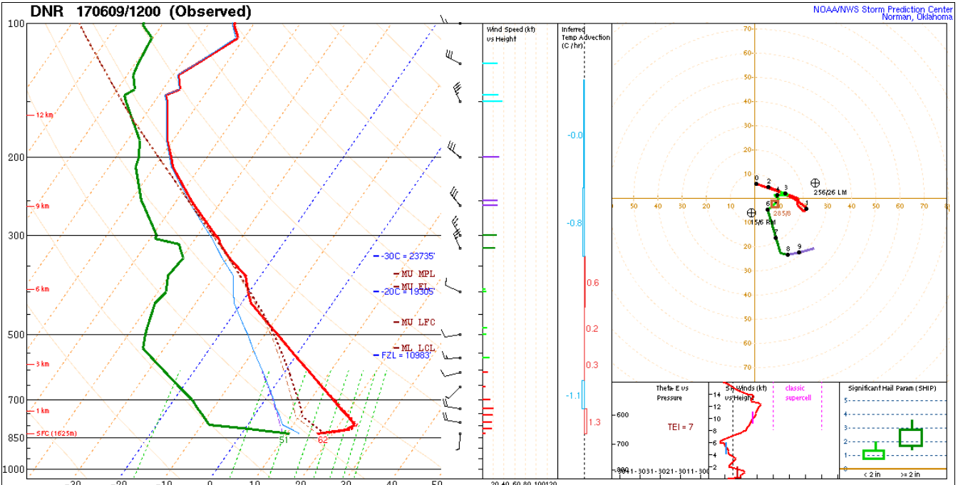
This morning, instead of showing water vapor imagery, shown below is the Denver atmospheric sounding from 6AM. Although the surface dew point temperature was still 51F, note the pronounced drying just above the surface. This will quickly mix down to the surface across nearly the entire state, with the exception of far eastern and southeastern areas where stubborn moisture will keep a slight chance of a weak shower/storm in the forecast.
The main headline today will be the combination of gusty winds, warm temperatures and very low relative humidity for central and western Colorado. An elevated fire danger will increase this afternoon.
Finally, minor flooding is currently occurring on the Arkansas River near La Junta. This will continue through the day, and a Low flood threat is posted here. Stay tuned to the Pueblo National Weather Service for updates.
Today’s Flood Threat Map
For more information on today’s flood threat, see the map below (hover over threat areas for more details). For Zone-Specific forecasts, scroll below the map.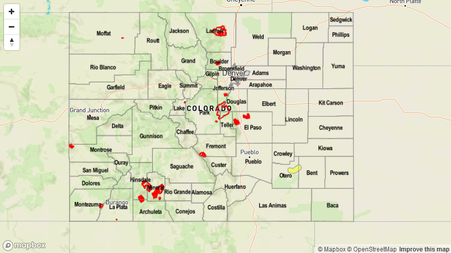

Zone-Specific Forecasts:
Southeast Plains:
Mostly sunny early then a few clouds with an isolated shower or storm possible for far southeast areas. Max 1-hour rainfall up to 0.25 inches. Precipitation related flooding is not expected. A Low flood threat is posted for the Arkansas River near La Junta for minor flooding.
Front Range, Urban Corridor, Palmer Ridge, Raton Ridge, Southeast Mountains, Northeast Plains:
Mostly clear and much warmer today with gusty winds. There will be an elevated fire threat across the foothills and higher elevations. Several creeks in the Front Range have elevated flows, but are expected to stay below Minor flood stage. Flooding is NOT expected today.
Grand Valley, Northwest Slope, Northern Mountains, Central Mountains, Southwest Slope, San Juan Mountains, San Luis Valley:
Mostly sunny and continued warm today with gusty winds developing later in the afternoon. An elevated fire danger will develop during the afternoon. Stay tuned to local National Weather Service forecasts for more detailed information.