Issue Date: Sunday, May 21st, 2017
Issue Time: 9:15AM MDT
— Flooding is NOT expected today
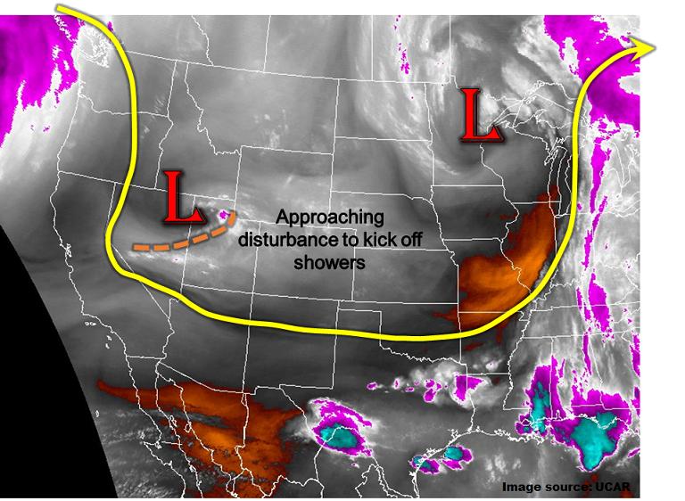
A large-scale trough has setup over central North America, causing below normal temperatures for wide areas of the Central Plains and Rocky Mountain states including Colorado. As the water vapor image shows, below, another disturbance that is embedded within the trough’s circulation, currently over the Great Basin, is racing its way east/southeast. This disturbance will quickly cross Colorado today, providing at least isolated precipitation for many. The main impacts will be scattered rain showers (with snow showers above 9,500 feet) across most of western Colorado earlier in the day, spreading east by the mid-afternoon. Across the Palmer Ridge and Southeast Plains, weak instability will develop from the sun’s heating. This implies that weak thunderstorms could be embedded in the shower activity. However, storm motions will be 35 mph or higher, and moisture content is not high enough to support rainfall intensity capable of a flood threat. Thus, flooding is not expected today anywhere in the state.
Today’s Flood Threat Map
For more information on today’s flood threat, see the map below (hover over threat areas for more details). For Zone-Specific forecasts, scroll below the map.

Zone-Specific Forecasts:
Northeast Plains, Front Range, Urban Corridor, Raton Ridge, Southeast Mountains, Southeast Plains, Palmer Ridge:
Scattered clouds early, then isolated to scattered showers and perhaps a weak thunderstorm developing by early afternoon and lasting into the overnight hours. Max 1-hour rain rates of 0.6 inches per hour will be possible in the Southeast Plains with lower rain rates elsewhere. Snow level 9,500 feet lowering to 7,500 feet overnight. Flooding is not expected today.
Primetime: 1PM to 7PM with showers continuing into the overnight hours
San Juan Mountains, Southwest Slope, Grand Valley, San Luis Valley, Northwest Slope, Northern Mountains, Central Mountains:
Partly to mostly cloudy skies with an increase in rain and snow showers by early afternoon. Coverage will be highest along and north of the I-70 corridor. Precipitation is expected to last into the late evening hours. Max 1-hour rain rates up to 0.3 inches with max 24-hour precipitation up to 0.5 inches. Snow level 9,000 feet lowering to 7,500 feet overnight. Flooding is not expected today.
Primetime: 1PM to 6PM