Issue Date: 5/5/2017
Issue Time: 8:35 AM
NO FLOOD THREAT IS FORECAST.
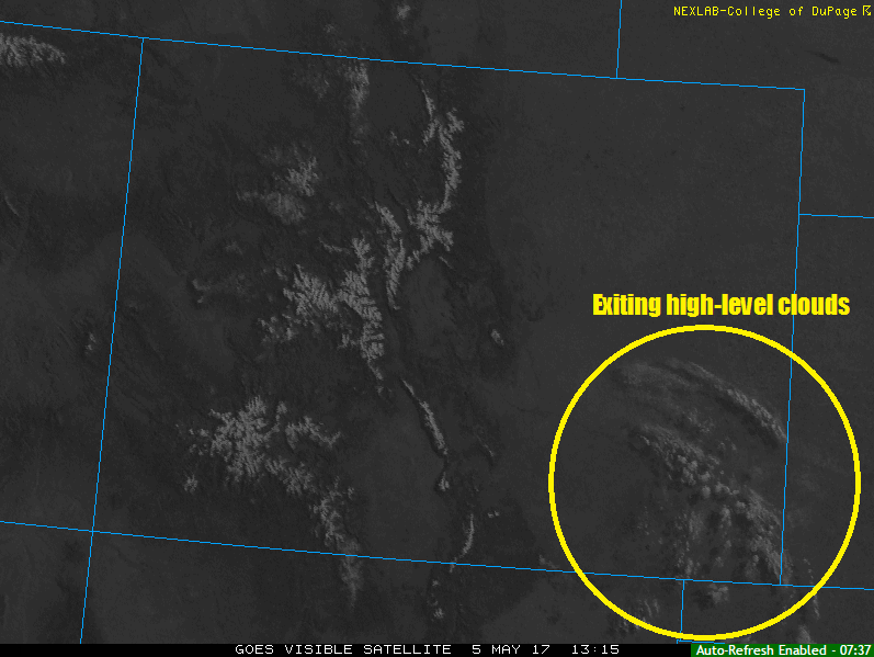
A strong high pressure ridge aloft, combined with dry air over the state, will lead to another sunny and pleasant day across Colorado. The few high clouds over the southeastern plains (shown in visible image below) will move out/dissipate over the next few hours. Aside from a few shallow, puffy clouds over the higher terrain this afternoon/evening, nothing but blue skies are expected. The weather will provide the perfect end to the work week.
Today’s Flood Threat Map
For more information on today’s flood threat, see the map below (hover over threat areas for more details). For Zone-Specific forecasts, jump below the map.

Zone-Specific Forecasts
Urban Corridor, Palmer Ridge, Northeast Plains, Southeast Plains, and Raton Ridge:
Sunny and dry conditions are expected today, with the few high clouds over the Southeast Plains exiting/dissipating by the early afternoon hours. High temperatures will be a few degrees warmer than yesterday, with a few locations flirting with 80° F.
Northern Mountains, Northwest Slope, Front Range, Southeast Mountains, San Juan Mountains, Southwest Slope, Central Mountains, Grand Valley, and San Luis Valley:
Aside from a few puffy clouds developing during the heat of the afternoon/early evening, nothing but sunshine and dry conditions are expected. High temperatures will be a few degrees warmer than yesterday, with lower valleys reaching into the low-to-mid 80s.