Issue Date: 5/2/2017
Issue Time: 9:30 AM
NO FLOOD THREAT IS FORECAST.
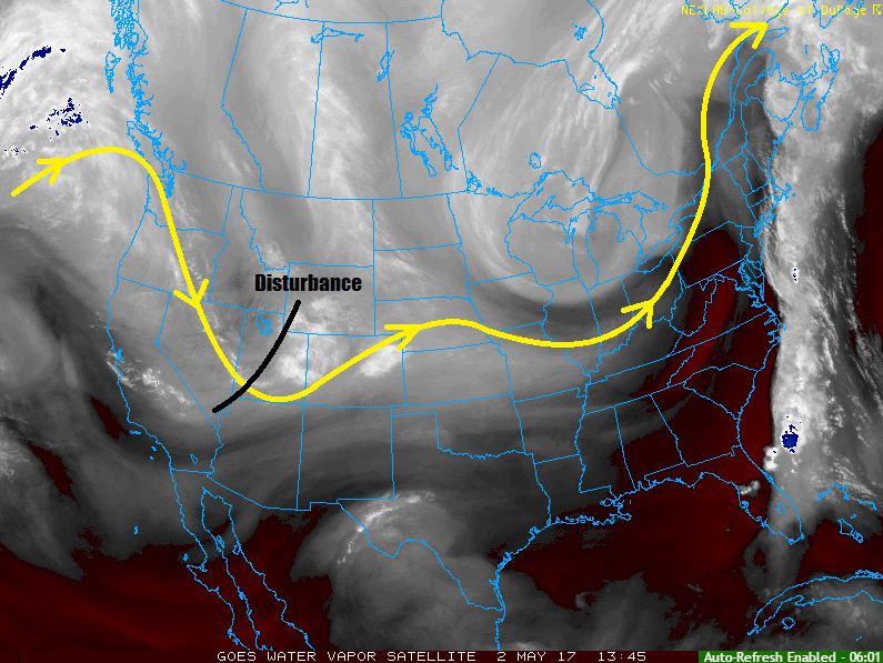
As noted on the water vapor image below, and upper-level disturbance will rotate across the region today, resulting in unsettled weather through the period. Most of the precipitation will be in the form of rain and snow (above ~9000 feet) showers. There will be a *bit* of instability available, so a few garden-variety thunderstorms are possible. The threat from thunderstorms will mainly be gusty winds and brief periods of moderate rainfall. Moisture is still lacking in terms of a flood threat, so no flood threat will be issued. Later this evening and overnight, snow levels will fall to around 7,000-8,000 feet.
Generally speaking, rainfall totals will range from a trace to 0.5 inches (with pockets of rainfall up to 0.7 inches). Snow totals will generally range from 1-3 inches, with pockets of snowfall up to 6 inches across the higher peaks of the Northern and Central Mountains regions. For more information, please check the zone-specific forecast discussions below.
Today’s Flood Threat Map
For more information on today’s flood threat, see the map below (hover over threat areas for more details). For Zone-Specific forecasts, jump below the map.

Zone-Specific Forecasts
Urban Corridor, Palmer Ridge, Northeast Plains, Southeast Plains, and Raton Ridge:
Scattered-to-widespread showers, and a couple thunderstorms, are expected today/tonight, with lingering showers expected into the morning hours tomorrow. Rain rates will generally be light (0.1-0.25 inches/hour), with a few heavier rain rates (0.4-0.7 inches/hour) underneath thunderstorms. The main threats from thunderstorms will be gusty winds, brief periods of moderate rainfall, and pea-sized hail. The far Southeast Plains have the best opportunity for a stronger thunderstorm, with hail up to 0.75” in diameter.
Timing: Noon – Midnight, with lingering showers into the early morning hours
Northern Mountains, Northwest Slope, Front Range, Southeast Mountains, San Juan Mountains, Southwest Slope, Central Mountains, Grand Valley, and San Luis Valley:
Scattered rain and snow showers are expected today/tonight, with most precipitation ending around 10-11 PM. A few lingering showers will hang around the Front Range and Southeast Mountains into the early morning hours. A couple garden-variety thunderstorms cannot be ruled out, thanks to the presence of marginal instability. Any thunderstorms will bring a threat of gusty winds and pea-sized hail, with rain rates 0.2-0.4 inches/hour. Most rainfall will occur at rates of 0.05-0.15 inches/hour.
The best coverage of precipitation will occur in the Front Range, Southeast Mountains, Northern Mountains, Central Mountains, and Northwest Slope regions, with the least amount of coverage across the Southwest Slope.