Issue Date: 5/1/2017
Issue Time: 9:30 AM
NO FLOOD THREAT IS FORECAST.
Welcome back to the Colorado Flood Threat Bulletin for the 2017 season.
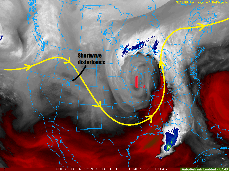
A shortwave disturbance (noted in water vapor image below) embedded in northwesterly flow aloft will trigger isolated-to-scattered rain/snow showers across Colorado through this evening. Generally speaking, most of the activity will occur north of I-70, thanks to better environmental support from the passing disturbance. Moisture values are seasonably low, so precipitation will remain well below any flood threat thresholds. Shower activity will end during the late evening hours with dry conditions expected overnight for the state.
Today’s Flood Threat Map
For more information on today’s flood threat, see the map below (hover over threat areas for more details). For Zone-Specific forecasts, jump below the map.

Zone-Specific Forecasts
Urban Corridor, Palmer Ridge, Northeast Plains, and Southeast Plains:
Mostly sunny skies this morning will give way to increasing clouds through the afternoon and evening hours as the disturbance moves overhead. Most showers will remain light, with maximum rain rates around 0.1-0.3 inches/hour. Most of the shower activity will occur north of I-70, and near the mountains/Cheyenne Ridge. Shower activity will come to an end between 6-8 PM, with dry conditions expected overnight.
Northern Mountains, Northwest Slope, Front Range, Southeast Mountains, San Juan Mountains, Southwest Slope, Central Mountains, Grand Valley, Raton Ridge, and San Luis Valley:
Orographic lift will combine with the disturbance aloft to produce isolated-to-widely scattered showers through the early evening, mainly for the Northern Mountains, Northwest Slope, Central Mountains, and Front Range regions. Elsewhere, shower activity cannot be ruled out, but will be less in both number and intensity. Expect precipitation to fall as snow above 10,500 feet, with rain below. Maximum rain rates will be 0.1-0.25 inches/hour, and snow accumulations will be light (Trace-3 inches).
Showers will come to an end during the early evening hours, with dry conditions expected overnight.