Issue Date: Friday, September 23rd, 2016
Issue Time: 9:00AM MDT
Summary:
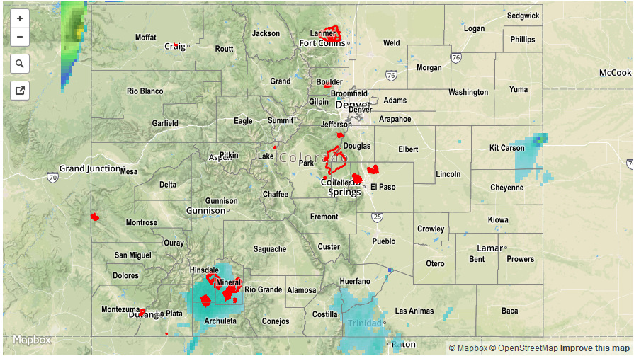
A strong cut-off low continued to creep closer to Colorado, providing plenty of dynamics to cause widespread showers and some thunderstorm activity mainly over the western slope. Fortunately, temperatures were rather cool and instability was limited with heavy rainfall kept to a minimum. However, it was a very close call as parts of northeast Utah received over 2 inches of rainfall with numerous reports of flooding and debris slides. Back in Colorado, rainfall amounts in the 0.25 to 0.75 inch range were common across parts of the San Juans and Central Mountains, with lower amounts farther north. At higher elevations, it was just warm enough to keep most of the precipitation as rainfall, with the snow level staying above 13,000 feet (this will change today and Saturday). Perhaps more impactful than the rainfall, steady strong winds were noted mainly across higher elevations. Gusts up to 58 mph were recorded in parts of the San Juans. This was expected as there was a High Wind Watch for parts of extreme western Colorado.
East of the Continental Divide, it was another seasonably mild and partly cloudy day. A few weak thunderstorms and showers rumbled, and raced, across the Southeast Plains late in the afternoon where some higher low-level moisture was found. However, these storms were moving so rapidly they did not have enough time to produce heavy rainfall in any given location. Nonetheless, up to 0.6 inches of rainfall fell across mainly rural locations in Las Animas, Kit Carson and Cheyenne counties.
Flooding was not reported on Thursday. For rainfall estimates specific to your area, check out our Storm Total Precipitation map below.